Storm could bring record snow to areas of Rocky Mountains
HELENA, Mont. - A massive storm is expected to bring record snow and cold unusually early to parts of the Rocky Mountains, where residents were warned to brace for widespread power outages, crop damage and treacherous roadways, meteorologists said Friday.
The storm moving into the region on Friday was expected to last three days, bringing strong winds and rain that will turn into snow over the weekend.
That will be followed by temperatures plunging to unseasonably cold levels early next week, with the coldest spots dropping to the teens and 20s.

(Nancy Utter)
"This is going to be a very long duration, wet event," said National Weather Service lead meteorologist Paul Nutter.
Cities that haven't seen September snow in decades canceled sporting events and readied their street plows, while residents brought in their garden vegetables and covered plants ahead of the hard freeze.
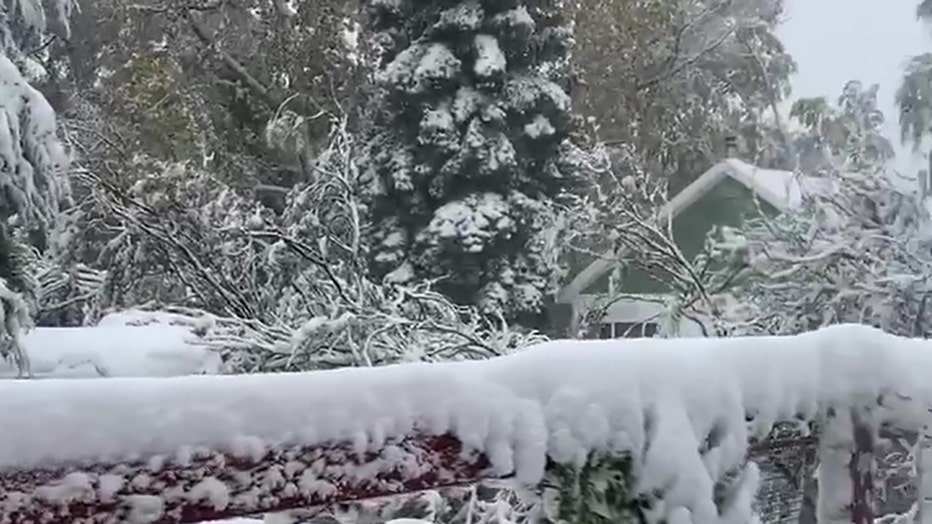
Nancy Utter, who lives in Augusta, Montana, took video from her porch showing the early winter wonderland as birds could be heard chirping.
"Robins, warblers and yellow finches [are] trying to get to my sunflowers but can't get through the wet snow sitting on them," Utter wrote in the video's caption.
The brunt of the storm is expected to hit Montana's Rocky Mountain Front and Glacier National Park, where a total of between 1 and 4 feet of snow is forecast to fall through Sunday. Wind gusts of up to 50 mph were expected to cause blizzard conditions in some areas and damaging waves on Flathead Lake.
One community in the storm warning area, Cut Bank, was expected to break its 15-inch snowfall record for September with this single storm. Great Falls' 13-inch September record may be threatened, too, Nutter said.
Winter storm watches also have been issued in eastern Washington, the Idaho panhandle, western Montana and northwestern Wyoming, where lesser amounts of snow were expected to fall.
Isolated snowstorms in the mountains aren't unusual for September, but the amount of snow being forecast and the storm's vast area make it a potentially historical event, Nutter said.
He said it was too early to link the storm to the effects of climate change, and that meteorologists are instead focused on what the storm will do.
"In general, scientists are seeing with a warmer planet that individual weather systems are becoming a little more energized," he said.
Glacier National Park instituted some temporary road and campground closures ahead of the storm. Elsewhere, Montana wildlife officials and avalanche centers warned hunters and other outdoor recreationists to be careful in hazardous backcountry conditions.
NorthWestern Energy was increasing staffing at its customer service centers and preparing equipment to respond to power outages, said spokeswoman Jo Dee Black, but cautioned that call wait times might be longer if the outages are widespread.
In Missoula, which has not received snow in September since 1983, state Department of Transportation officials were preparing snowplows and sanding trucks and putting up "watch for ice on bridge" signs, maintenance chief Steve Felix told the Missoulian.
The warm roadbeds will probably melt most of the snow during the weekend, Felix said, but the cold temperatures forecast for Monday could create black ice while drivers likely haven't put on their snow tires yet.
"I'm concerned people will not be ready for this," he said. "They shouldn't take this storm lightly."

