Superior National Forest fire: Evacuations, closures issued in northeastern Minnesota

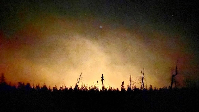
The Greenwood Fire burning in the Superior National Forest in northwestern Minnesota. (U.S. Forest Service / FOX 9)
ISABELLA, Minn. (FOX 9) - Crews are continuing to battle a large fire in the Superior National Forest in Minnesota’s Arrowhead region, dubbed the Greenwood Fire, which has now grown to about 4,000 acres. The fire, and others in the region, have prompted evacuations and closures in the northeastern part of the state.

Greenwood fire grows in size in Superior National Forest
A fire burning in northern Minnesota is continuing to spread as crews work around the clock to battle flames.
Greenwood Fire
The fire was first detected on Sunday, Aug. 15 around 3 p.m. on the Laurentian Ranger District, according to the U.S. Forest Service. The fire is near Greenwood Lake, approximately 15 miles southwest of Isabella. At last check, the fire was estimated to be around 4,000 acres. For more perspective, 4,000 acres is about 6.25 square miles.

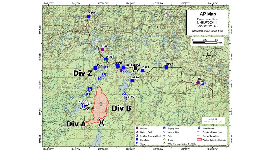
The Greenwood Fire in the Superior National Forest started on Sunday and has grown to over 3,200 acres. (U.S. Forest Service - Superior National Forest / FOX 9)
Fire suppression efforts include both ground and air resources. Planes have been seen scooping water out of nearby Sand Lake to drop on the fire.

Planes collect water from nearby lakes to fight Greenwood Fire in Superior National Forest
Firefighting efforts continue for the Greenwood Fire in the Superior National Forest in Minnesota's Arrowhead region. Planes dive down into Sand Lake to collect water and drop it on the flames. At last check, the wildfire had grown to 2,000 acres.
There will be a public meeting on the fire Thursday night at 6 p.m. at the Wolf Ridge Environmental Center in Finland.
The cause of the fire is currently under investigation.
Evacuations ordered
The fire is threatening homes, cabins, homes and recreational sites. The Lake County Sheriff’s Office has issued evacuation orders for McDougal Lake, Sand Lake, the Highway 2 corridor and just north of Highway 1. Lake County Emergency Management has a Red Cross shelter up and running at the Finland Community Center for those who are displaced or unable to reach their homes due to the fire and related road closures.

Greenwood Fire in northern Minnesota spreads to more than 3,000 acres
Firefighters are working to contain the Greenwood Fire in northern Minnesota.
As of Tuesday, the sheriff’s office had evacuated around 80 people from the area.
Road, forest closures
Hwy. 2 is closed from Forest Highway 11 to Hwy. 1. Hwy. 1 is closed from New Tomahawk Road to Lankinen Road.
A Forest Service closure order is in place across areas within the Kawishiwi, Laurentian and Tofte Ranger Districts and a small portion of the Boundary Waters Canoe Area Wilderness. The order affects all lands, waters, trails, portages, canoe routes, BWCAW entry points and recreation sites within the closure area. However, private property owners can access private property.
Air quality alert issued
The Minnesota Pollution Control Agency has issued an air quality alert effective until 3 p.m. on Friday, Aug. 20, for the inland portion of Lake County. The affected area includes Stony River Township and Fall Lake Township.
According to the MPCA, smoke will continue to impact areas near and immediately downwind of the fire to the north and northeast through at least Friday as the fire continues to burn. Fine particle levels are expected to reach the Orange AQI category, a level that is considered unhealthy for sensitive groups, for the affected area.
Additional fires
Several additional fires are burning in the Superior National Forest. At last check, there were at least 12 fires burning in the forest.
Due to the Whelp Fire, which is four miles northwest of Sawbill Lake, the Forest Service is closing portions of the BWCA including Hub Lake, Mesaba Lake, Dent Lake, Chaser Lake, Bug Lake, Louse Lake, Louse River, Poe Lake, Mug Lake, Wine Lake, Frederick Lake, Hug Lake, Duck Lake, Zenith Lake, Trail Lake, Boze Lake, Frond Lake, Lujenida Lake and all other lands, waters, portages and canoe routes in that area.
The Whelp Fire is small at only 10-20 acres, but no firefighting crews have been sent in due to difficult access and safety concerns. Planes are continuing to drop water on the fire from above, which has kept it contained to its current footprint.
There are also several fires burning across the Minnesota-Canada border in Quetico Provincial Park, which the Forest Service said have the potential to spread into Minnesota near Crooked and Iron Lakes. BWCAW permits in the Crooked Lake and Iron Lake closure area have been canceled until Aug. 27.

