Minnesota Weather: Wind Chill Advisory is in place for most of the state until Sunday morning
We stay cold for the remainder of the weekend with highs on Sunday barely making it above 0°F and wind chills staying well below zero all day long. A Wind Chill Advisory is in place for most of the state until Sunday morning. A Wind Chill Warning goes into effect Sunday night for far NW MN because it is expected to feel like -40 to -45.
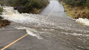
Hawaii firefighter swept away in storm drain as heavy rains drench Maui
The firefighter was listed in critical condition.
Drone footage shows river with enough garbage to fill 4 Olympic swimming pools
In the Drina River of Eastern Europe, a combination of bad weather and a build-up of waste in riverside landfills led to an significant accumulation of garbage.
Minnesota weather: How the snow this year compares
You are not imagining it...there has been a lot of snow this season. At this point in January, we are above the seasonal average. If we pick up the average snowfall for the next 3 months, it would give us about 75 inches for the season. That would be a top 5 season since 1990 and a top 10 since 1980.
Winter weather advisory in effect Wednesday night until Thursday
A winter weather advisory is in effect for much of southern and southeastern Minnesota Wednesday night into Thursday, as some areas are expected to get anywhere from 3 to 9 inches of total snowfall.
Wednesday offers another calm before more snow
An approaching storm system will bring snow showers Wednesday night into Thursday morning. Southern and Southeastern Minnesota specifically will see the most totals of accumulation, with 6 to 9 inches of snow possible.
Scientists divert lightning strikes using lasers
A demonstration was conducted on a mountain in Switzerland.
Why atmospheric rivers could become more frequent as world transitions out of La Niña
The climate patterns created by the El Niño Southern Oscillation (ENSO) could allow for more heavy rain events to impact California.
Snow and rain ends Tuesday until later this week
Snow and rain accumulation are done for now, marking the end of the first storm this week. Minnesotans are now waiting on the second storm to make its way west, which could offer measurable amounts of snow in the southern portion of the state Wednesday into Thursday.
Monday brings rain, more moderate temps after cold and snow streaks
Monday morning might feel more like late spring or early summer than the middle of winter to some. Temperatures will be above freezing all day long, offering rain throughout the day for the Twin Cities during daylight hours, until evening which could switch to slight snowflakes.
Biden approves California disaster declaration as another atmospheric river storm prepares to pummel state
Storm after storm has been slamming into the Golden State since the end of December.
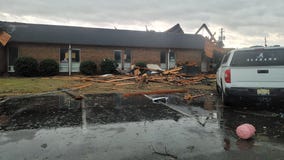
Severe weather outbreak turns deadly after violent storms tear through South
Storm damage was reported in nine states, with Alabama appearing to be the hardest hit during the severe weather outbreak.
'Worst day of my life': Tornado destroys Selma daycare, trapping dozens of children inside
A daycare worker said she hovered over infants as the tornado approached Selma, Alabama. She's thankful that only one baby received a cut on her forehead and cheek.
What does all this rain in California mean for the wine?
A winery proprietor said, "let's keep it coming," when talking about the historic atmospheric river-fueled parade of storms slamming the Golden State.
Firefighters rescue mother giving birth in the middle of flooded California riverbed
The storm that began Monday dumped more than a foot (30 centimeters) of rain at higher elevations in central and Southern California and buried Sierra Nevada ski resorts in more than 5 feet (1.5 meters) of snow.
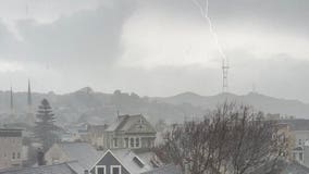
Dramatic photo shows lightning stike Sutro Tower during Bay Area's thunderstorms
The severe weather to slam the Bay Area in recent weeks have resulted in torrential rains, flooding, mudslides, and powerful lashing winds that have knocked out power and brought down once-towering trees. On Tuesday, there was also hail, thunder, and lightning.
Watch: California golfers flee '45-foot' waves crashing onto Pebble Beach course
Golfers were sent scrambling for safety as massive waves overtook an ocean-front golf course during one of a series of atmospheric rivers to slam into California in recent weeks.
Freezing fog could cause trouble for drivers Monday morning
Freezing fog could cause some trouble for drivers on their Monday morning commute in the Twin Cities.
Hurricane hunters fly missions to California to study atmospheric river amid powerful storm
It may not be hurricane season, but Air Force and NOAA aircraft are still busy collecting data over the Pacific from November to March.
Sparks fly when truck is struck by lightning in North Carolina, video shows
JR Motorsports shared the dramatic video, joking that they were “starting the year off with a bang.”


