2 reasons why this Arctic blast is different than others
Friday’s forecast: It’s cold.
Temps will stay cold for a while. Nothing record-breaking, but make sure to take precautions if you're planning on being outside for extended periods of time.
(FOX 9) - The cold is here, and it’s going to stay a while.
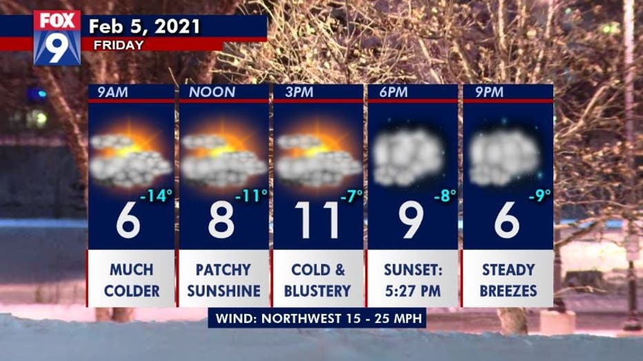
It will be cold Friday with wind chills staying subzero all day long thanks to persistent gusty breezes, although some patchy sun does look likely.

Day planner for Friday, February 5, 2020. (FOX 9)
The Arctic air that’s arriving is nothing unusual. It will likely have few, if any, record lows, and we hit these cold temperatures just about every year.

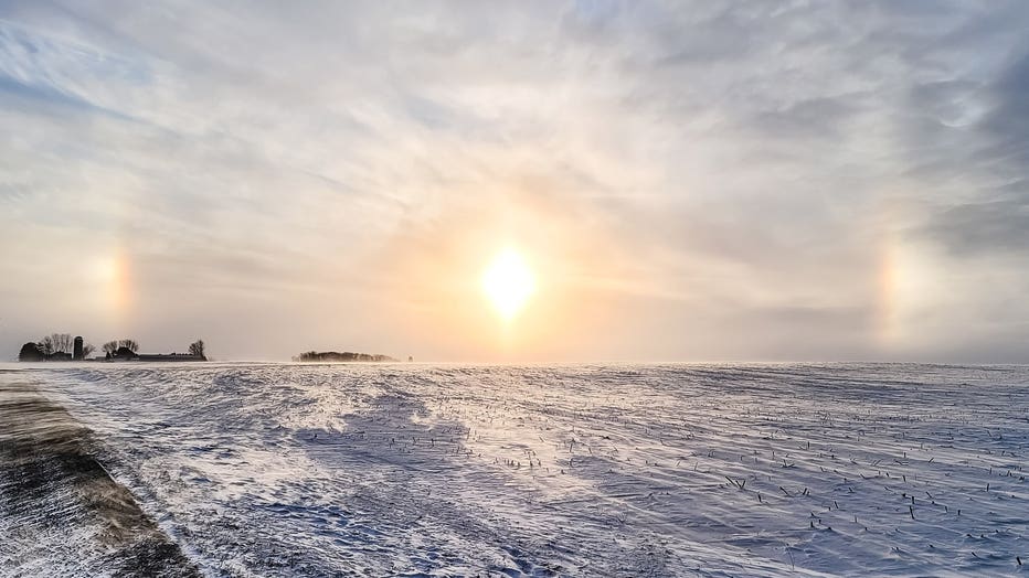
Sun dogs in rural Scott County on Friday, Feb. 5. (Greg Kellogg/FOX 9 / FOX 9)
But, there are two reasons why this is different:
- It's showing up with a lot of wind, dropping wind chills to dangerous levels for multiple days
- The persistence of this cold
A lot of times we bounce into the Arctic air for a couple days, then warm up for a few, then drop again. We generally bounce around. This time, we're diving into the arctic chill, and then sitting and wading in it for several days.

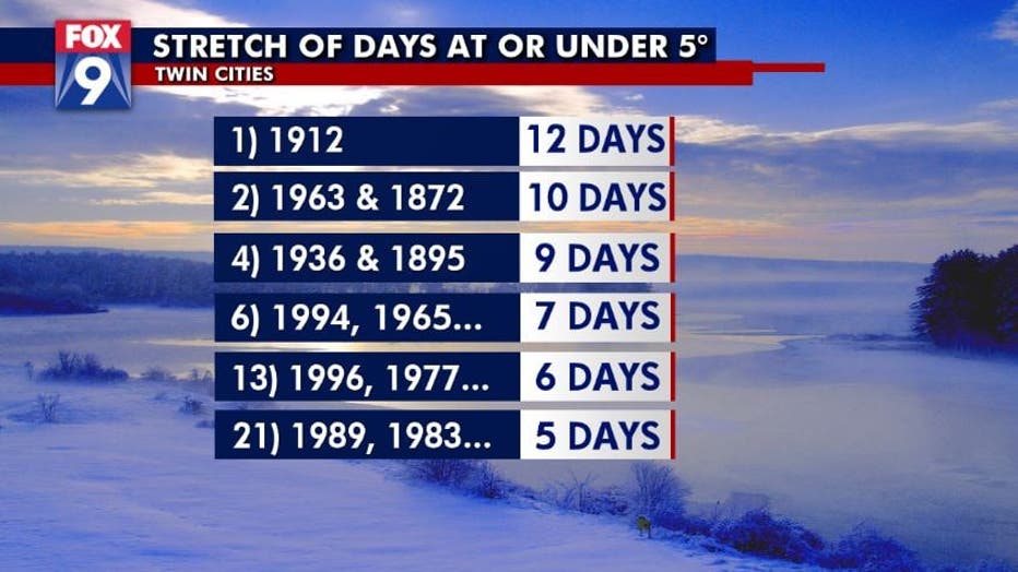
IF our temperatures manage to stay below 5 degrees for six consecutive days (which is our current forecast), it will be the first time we've done that since 1996. (FOX 9)
In fact, IF our temperatures manage to stay below 5 degrees for six consecutive days (which is our current forecast), it will be the first time we've done that since 1996. Yes... 25 YEARS!
Stay up to date on the winter weather by downloading the FOX 9 Weather App. It has the latest temperatures, snow totals, forecasts and school closings 24/7. Download it for Android or Apple.

