Twin Cities weather: 1 to 4 inches of morning snow before warm-up to 50s this week
MINNEAPOLIS (FOX 9) - A quick round of snow and wintry mix is bringing some melting and slushy accumulations across the area this morning. A few aggressive snow bursts with snowfall rates of one inch per hour helped folks in a narrow band just northwest and north of the immediate Twin Cities metro see 1 to 4 inches or more, from 3 inches in St. Michael and 4 inches in Ramsey to mnore than 2 inches in Buffalo and Wyoming.
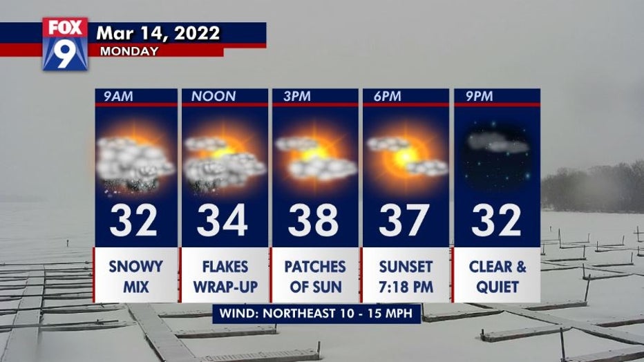
After sitting out the early morning snow and mix with barely a drip in the southern metro, big flakes of snow in a burst brings a dash of extra snow (and occasional mix) and one inch per hour snowfall rates across the rest of the Twin Cities area through mid-morning. Expect reduced visibilities and some slippery spots to continue for the rest of the morning.
All of the precipitation pushes east/southeast and gradually weakens through the lunch hour, allowing some partial sunshine to return and plenty of melting this afternoon as we climb into the thawing upper 30s!

Minneapolis-St. Paul weather dayplanner for March 14, 2022
Temps near and above 50 finally return to the Twin Cities and continue the melting starting tomorrow.

