

Minnesota weather: Quietest start to severe weather season in nearly 30 years
Thursday's forecast: Hazy with highs in the 80s
Some storms possible later tonight. The week should be sunny and dry.
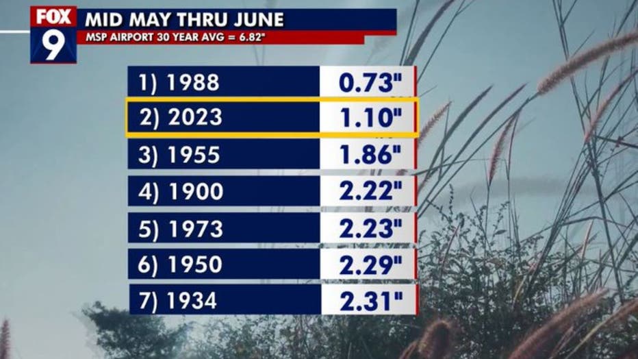
MINNEAPOLIS (FOX 9) - Much of Minnesota finally received some rain earlier this week after one of the driest stretches for this time of the year on record. Now tallying a little over an inch of rain officially in the Twin Cities, we will finish as the second-driest six-week period on record from mid-May through June, which is roughly the wettest time of year on average.
With the lack of rain, comes the lack of storms in what is usually the busiest time of year for severe weather as our strong storm chances usually peak in the first week or two of July. The quiet weather has led to just 75 severe weather warnings so far this year from the National Weather Service office in Chanhassen, which is the lowest number by the end of June since 1995.
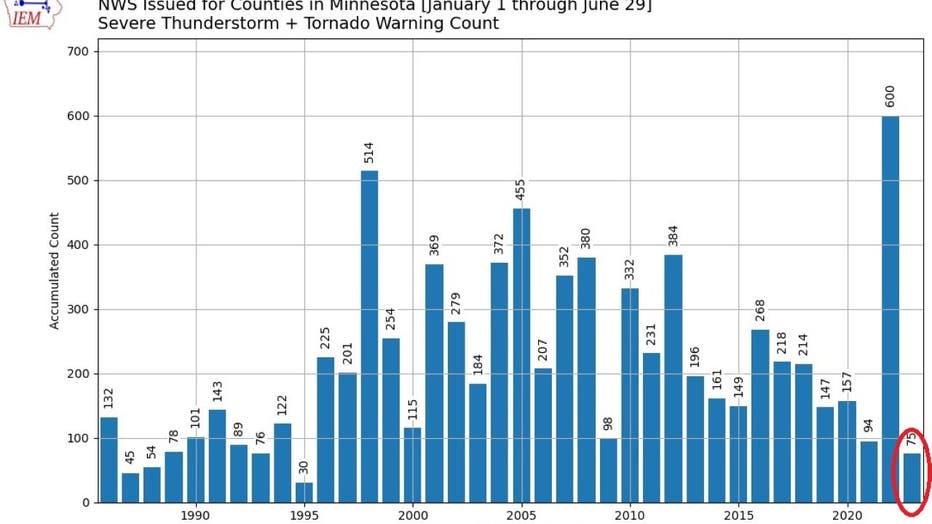
It's the exact opposite of last year when we had already cracked 600 warnings by this point in the year, which was by far the most active start since warning records began back in the 1980s. Our lack of rain and storms has been exacerbated by the persistent warmth as well. The Twin Cities is experiencing the fourth-hottest May to June combo on record with an average temperature (combination of the daily highs and lows) of just shy of 70 degrees.
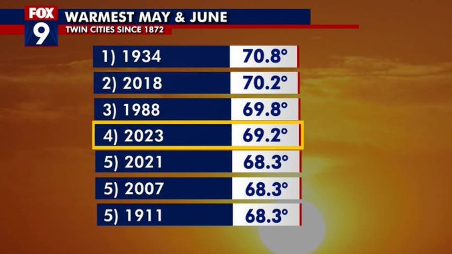
This is just warmer than our late spring and early summer of two years ago with an average temp just over 68 degrees. Three of the top five years have occurred since 2018, which could spell a larger and more concerning trend.
Stay safe and informed with the FOX 9 Weather App
Stay Sky Aware with the FOX 9 Weather App. Whether you are staying in one place or traveling, have your GPS locator on and your notifications turned on. No matter where you are, you will get an alert specific to that location. Apple Download | Android Download