

Minnesota weather: Significant moisture is finally heading for Minnesota this week

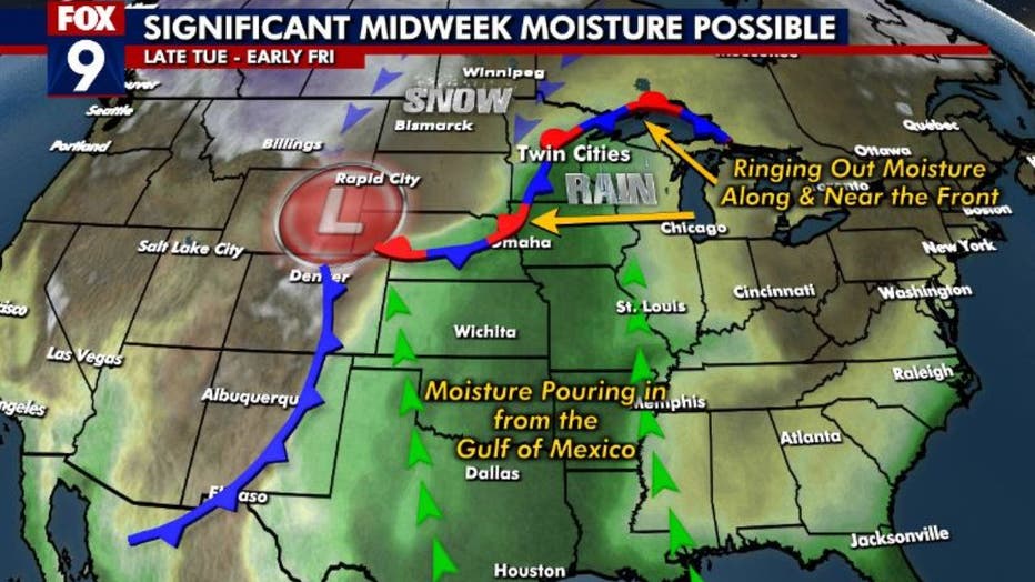
(FOX 9) - A very large pattern change this week across the Northern U.S. will give us the best chance for significant moisture in nearly three months. In fact, if all the stars align (metaphorically speaking) we have the opportunity to see one of the wettest weeks of November on record. Amazing that this could come after one of the driest stretches on record in the Twin Cities. The moisture certainly couldn't show up at a better time, moving in right before the ground freezes. This moisture will fall as rain, with some heavy downpours at times, as the cold air holds off until the tail end of this system.
Significant moisture is expected this week.
The change begins Monday night as southerly breezes start to increase and are not likely to stop until sometime late Thursday when they switch out of the north and draw in cooler air. This southerly flow will be impeded by absolutely nothing between here and the Gulf of Mexico, which means the door is wide open for a massive amount of moisture to roll into the Upper Midwest at much of the lower and mid-levels of the atmosphere.
We may waterlog the atmosphere so much in fact, that we could set a record high level of moisture in our column of the atmosphere for this time of year. The current forecast shows much of central and southern Minnesota will be in the 99th percentile for this time of year as seen in the image below in the dark green and blue zones.
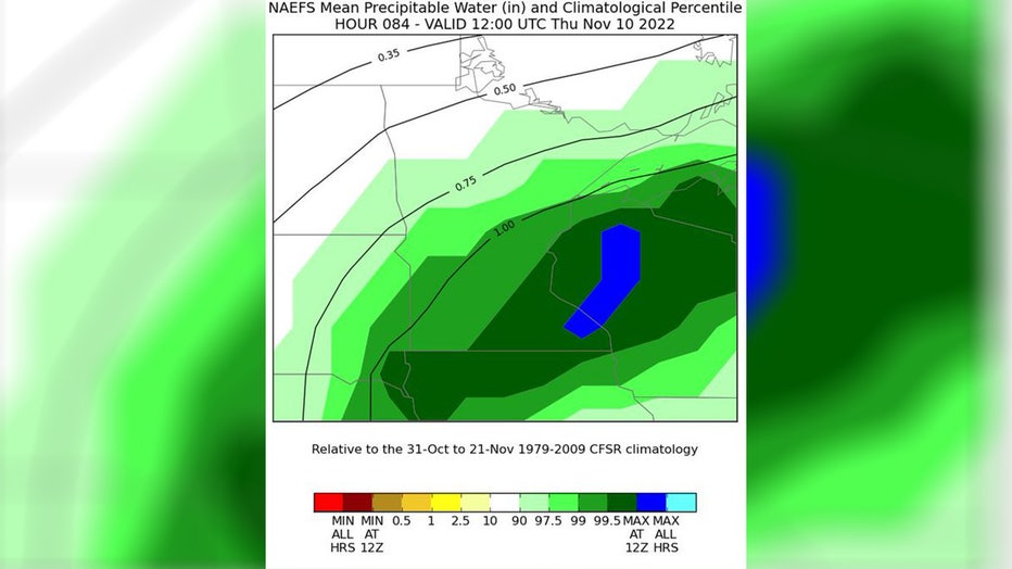
Mean precipitable water.
While a large amount of water vapor (moisture) is on its way, exactly how that translates to rainfall totals is a bigger mystery. The focal point to wring out this moisture will be a stationary boundary that meanders across central and/or southern Minnesota. The exact position and how the moisture interacts with it will be the main factors in what areas see the most rain, but this type of scenario often leads to some of the highest multi-day rainfall events here in the state.
Now, it is clearly no longer summer, so multiple rounds of flooding rains are exceedingly unlikely. Even more unlikely considering our current drought. However, the possibility for at least a few areas to get 2 or 3 inches of rain is quite high ... with at least small chances for someone across the area to exceed 4 inches.
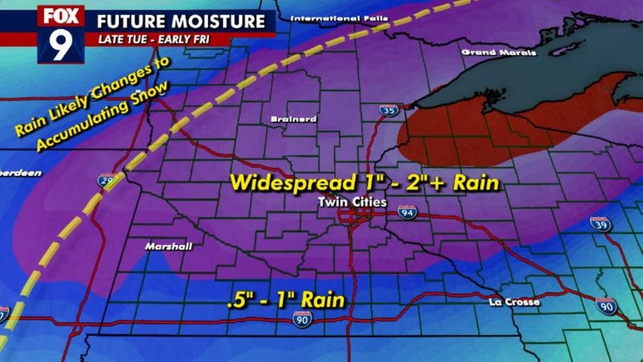
Future rainfall.
We will wrap MUCH colder air into this system late on Thursday, but the bulk of that air will likely stay out of our area until the precipitation is largely wrapped up. While a few flakes and even very minor coatings are possible, any snow totals of note would stay WAY to our northwest across mostly the Dakotas and far northwestern Minnesota.