

Minnesota weather: 2024 is the 3rd wettest on record to date in the Twin Cities
Wettest years to this point in the year. (FOX 9)
MINNEAPOLIS (FOX 9) - What a wild few years it has been here in Minnesota! Can't we just have an average year? Apparently not. Well, after three consecutive very dry summers, we are now making up for lost ground. Through the first week of August, it is the third-wettest year on record in the Twin Cities dating back to 1872.
In fact, we have nearly seen as much rain this year to date as we have during the last two years combined. While year-to-year variability is perfectly normal, the whiplash this time around is certainly more unusual.
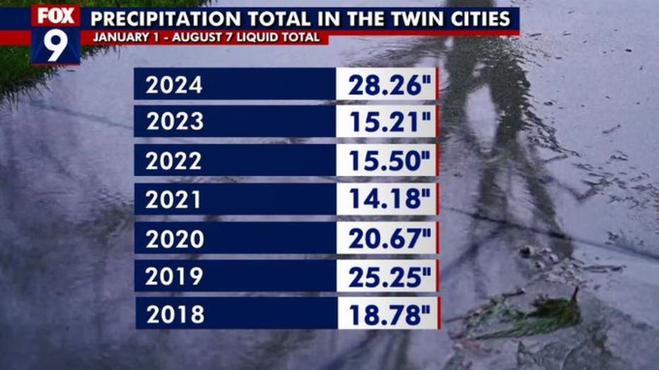
Precipitation total in the Twin Cities. (FOX 9)
After a little bit of a break in some of the rain for the second half of July, we resumed the very wet conditions in the first week of August with another large system bringing widespread amounts of 1 to 4 inches of rain over 24 hours. Thankfully, the ground had dried out enough that major flooding was not an issue, but many areas continued to see very saturated soils, leading to crop failures and tree falls, as roots have a tough time hanging on with very wet soil.
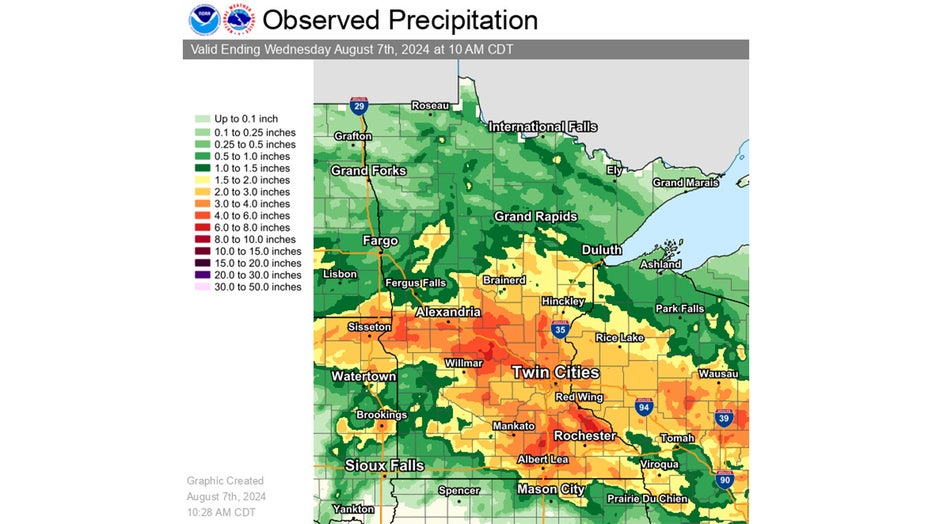
Rainfall last week. (National Weather Service)
What may be even more incredible is the rainfall totals in the Twin Cities could be a lot higher. If you go back to the really big rain event in June that led to several weeks of river flooding across much of central and southern Minnesota, the bulk of that moisture missed the metro. Look at some totals for southern Minnesota during those few days. While the Twin Cities received 2 to 4 inches on average, much of southern Minnesota received more than double that, with upwards of 10 inches in some places. If that ended up over the metro, then this would easily be the wettest year on record.
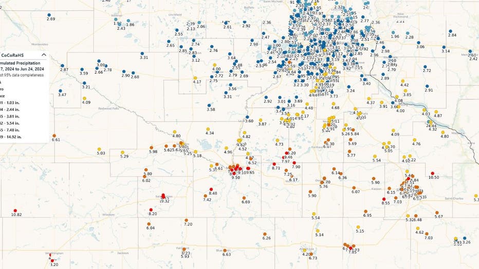
Rainfall totals in June. (FOX 9)
So, does it continue? Well, we are experiencing a bit of a break now, but considering our pattern hasn't changed much, I would imagine a wetter-than-average pattern will continue into the fall.