

Tornado observed near Rochester; tornado watch in southern MN, WI
MINNEAPOLIS (FOX 9) - A tornado has spun up in southeastern Minnesota, causing tornado warnings in the area as storms move through.
Find live updates on the storms below.
4:42 p.m. - Confirmed tornado near Fairchild, WI
The National Weather Service confirmed a tornado north of Highway 10 near Fairchild, Wisconsin. Law enforcement in the area said the tornado has lifted.
3:56 p.m. - Large tornado lifts Buffalo Co., WI; tornado warning remains
According to the National Weather Service, a large tornado in Buffalo County, Wisconsin has been lifted, but a tornado warning in that area remains in place in that area until 4:30 p.m.
3:12 p.m. - Tornado warnings continue in southern MN and WI
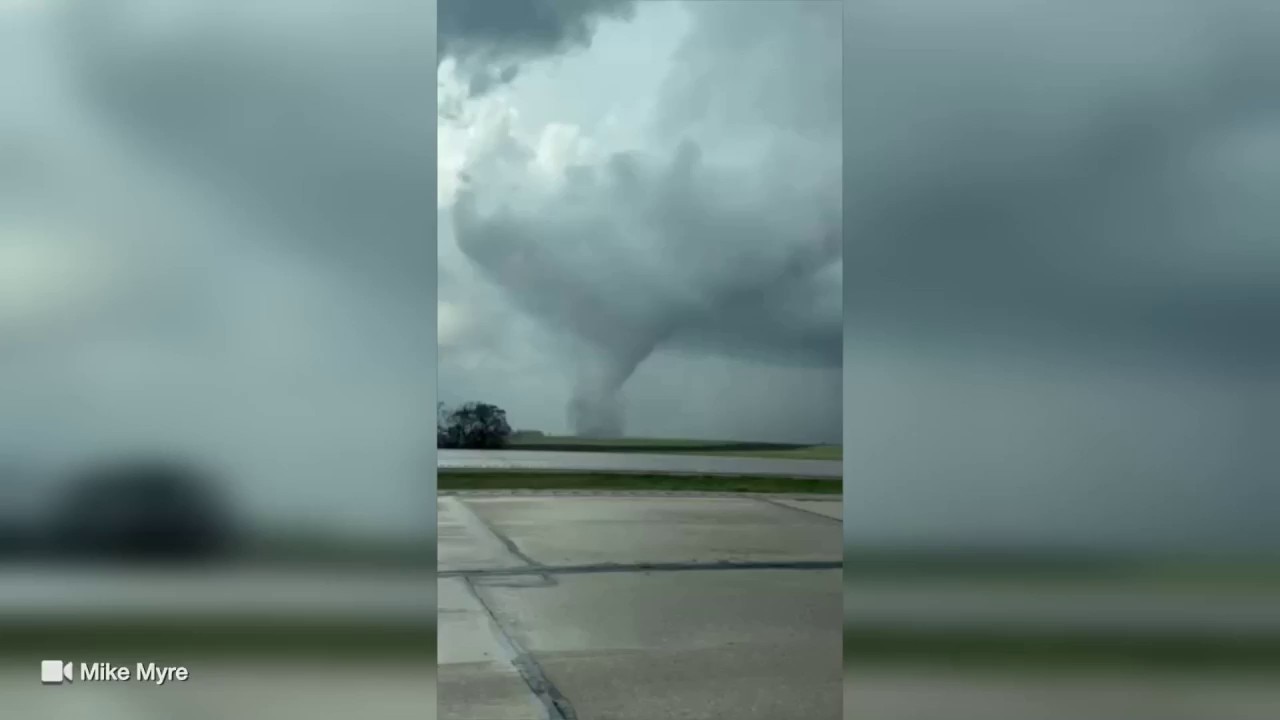
Tornado caught on video near Rochester
A tornado was observed by Mike Myre near Rochester as storms move through the area.
A portion of southeastern Minnesota continues to be under a tornado warning as storms move through the area.
2:47 p.m. - 7 active tornado warnings in the Midwest
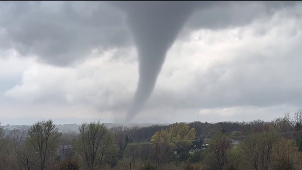
Tornado spotted during severe storms in MN
A tornado was reported during severe storms in southern Minnesota on Friday, April 17. FOX 9 viewer Jim Humble shared this video of a tornado in Marion Township.
According to FOX Weather, there are seven active tornado warnings in the Midwest, spanning across Minnesota, Iowa and Illinois.
2:43 p.m. - Golf ball-sized hail observed near Rochester
According to FOX Weather, golf ball-sized hail has been observed due to storms in the area.
2:30 p.m. - Tornado warning in Olmstead County
A tornado warning has been issued by the National Weather Service for Olmstead County until 2:45 p.m.
2:10 p.m. - Observed tornado near Rochester
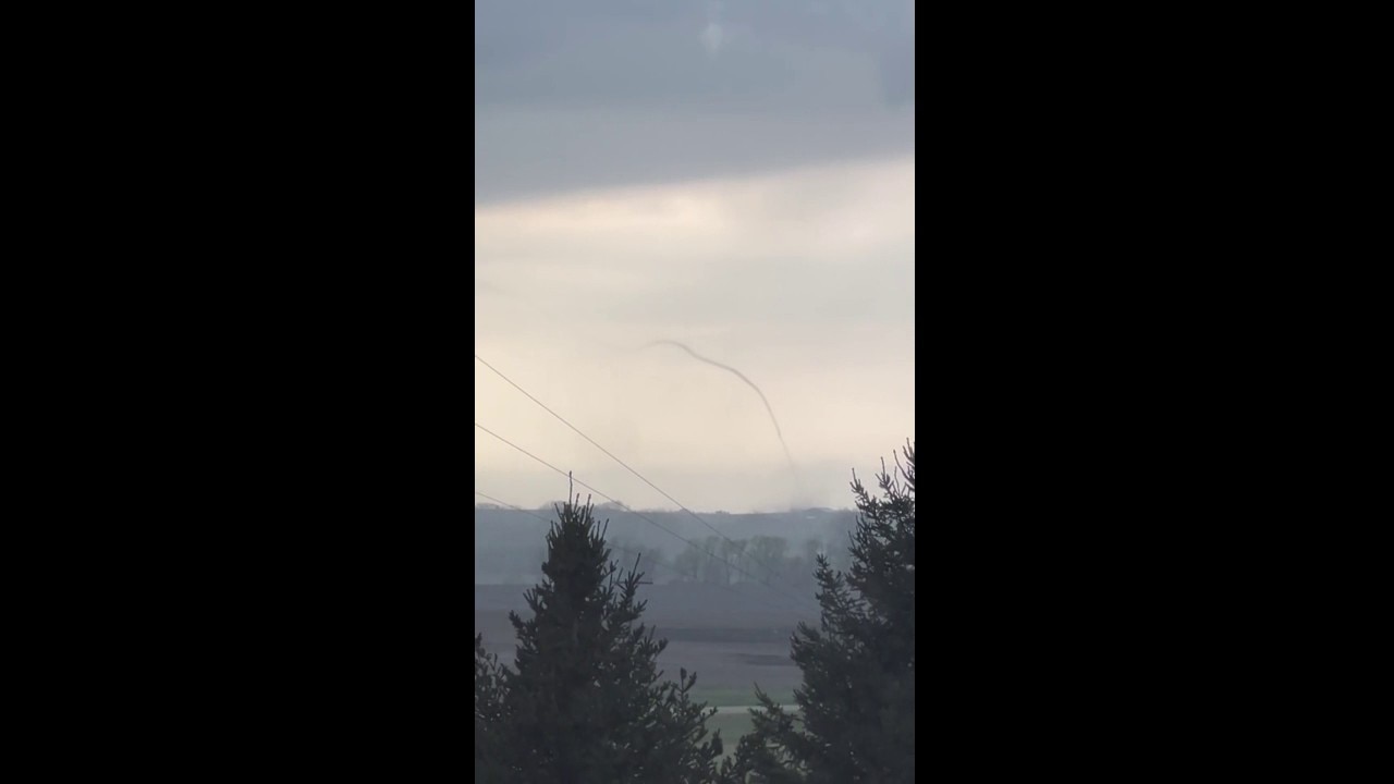
Tornado footage captured near Stewartville, Minnesota
Video shows the moment a tornado was caught on camera near Stewartville.
FOX 9 meteorologists are seeing an observed tornado near Rochester. As the cold front moves through the state, thunderstorms are becoming more severe.
1:45 p.m. - Tornado watch for parts of southeastern MN, WI

(FOX 9)
A tornado watch has been issued for a small portion of southeastern Minnesota, and for a large portion of southern Wisconsin and Iowa.
The watch is expected to go until 8 p.m.
12:30 p.m. – River flood warning for La Crosse County
The National Weather Service has issued a river flood warning for La Crosse County in Wisconsin.
The alert was issued at 10:55 a.m. on Friday and is set to expire at 8:30 p.m. on Saturday.
Noon – Weather forecast update
MN weather: Friday afternoon update
FOX 9 meteorologist Keith Marler has the latest forecast update.
FOX 9 meteorologist Kieth Marler has the latest update on thunderstorms working across the region. Find that update above.
9:37 a.m. – Severe thunderstorm warning for southern MN
A severe thunderstorm warning has been issued for parts of southern Minnesota, including Northfield, Cannon Fall and Randolph, until 10:15 a.m. on Friday. The National Weather Service warned winds up to 50 mph and half-dollar-sized hail are possible.
9:25 a.m. – Severe thunderstorm watch issued
The National Weather Service has issued a severe thunderstorm watch for parts of eastern Minnesota and western Wisconsin until 5 p.m. on Friday. Threats include lightning, hail, and isolated wind gusts up to 70 mph.

As of 9:30 a.m., there is a severe thunderstorm watch for eastern Minnesota and Western Wisconsin until 5 p.m. Friday. (FOX 9)
9:20 a.m. – Special weather statement issued
The National Weather Service has issued a special weather statement for Owatonna, Faribault and Northfield until 10 a.m. on Friday.
The line of storms also prompted a severe thunderstorm warning for Owatonna, which expired at 9:15 a.m.
Storm chances Friday in Minnesota
Scattered storms could develop in the Twin Cities metro around lunch or early afternoon, though the better chances for stronger storms shift east, especially toward southeastern Minnesota and western Wisconsin.
The metro area is under a level 1 marginal risk for severe weather, with a higher level 2 slight risk and level 3 enhanced risk for southeastern Minnesota. Hail, wind and an isolated tornado are possible with this system.
Showers and storms are expected to wrap up by the evening, leaving behind blustery winds and chilly temperatures in the 40s.

Severe weather risk map for April 17, 2026. (FOX 9)