

Minnesota weather: Tropical heat, strong storms possible Wednesday
MINNEAPOLIS (FOX 9) - Expect another hot and humid day on Wednesday. It will be mostly dry, but strong storms are possible later in the afternoon and evening.
Wednesday’s forecast
The humidity is sticking around, making it feel tropical on Wednesday. Temperatures in the metro are in the lower 90s with feels like temperatures closer to 100 degrees.
Morning cloud coverage moves out for afternoon sunshine. It will be a dry day for many of us, but chances for strong storms are possible later in the afternoon and evening.
The scattered storms pose a level 2 risk for severe weather up and down the I-94 corridor. Northern Minnesota is under a level 1 marginal risk, while extreme southwestern Minnesota near the Iowa border is under a level 3 enhanced risk. Damaging winds, large hail, and heavy rain are possible with these storms.
Rain is expected to arrive in the metro between 7 p.m. and midnight on Wednesday. Showers will linger into Thursday and could produce thunder, lightning, and heavier rain. However, the chance for stronger storms is higher on Wednesday night.
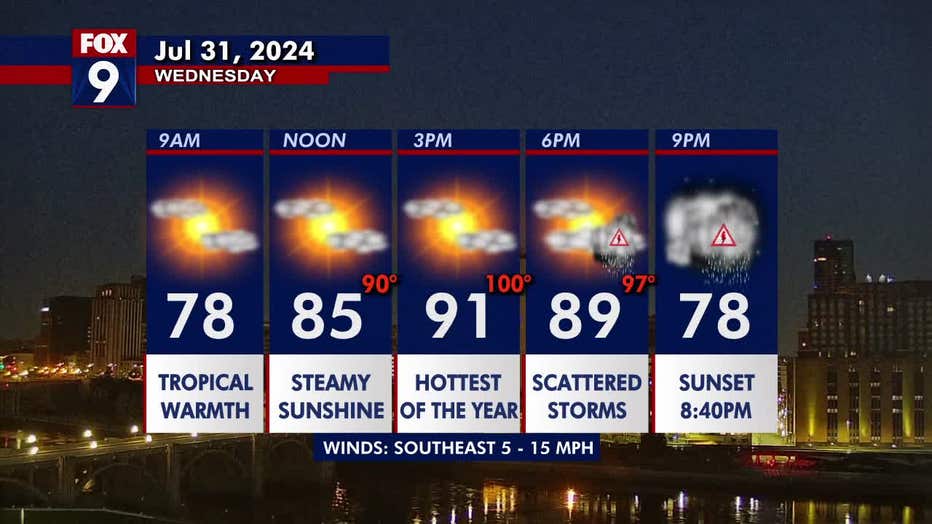
(FOX 9)
Looking ahead
Temperatures are not as hot for the first day of August with a high of 83 degrees on Thursday.
A northerly flow kicks in by Friday, dropping the dew points, but temperatures will remain high in the upper 90s. The heat follows us into the weekend, but a cooling trend arrives heading into next week.
Here’s a look at your seven-day forecast:
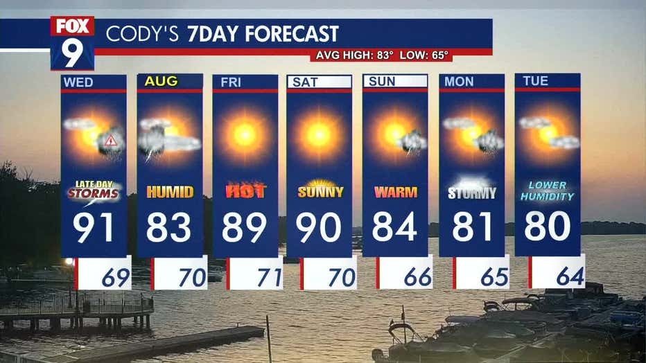
(FOX 9)