

Live updates: Severe Thunderstorm Watch until 8 p.m. includes south metro
MN weather: Shower and storm chances linger Wednesday
Scattered showers and storms remain possible Wednesday, though many areas will see dry periods and some sunshine. Drier and more comfortable weather returns Thursday. FOX 9 meteorologist Cody Matz has the forecast.
MINNEAPOLIS (FOX 9) - We’ve had on and off showers and storms Wednesday, and they’re expected to continue into the afternoon and evening hours.
1:40 p.m. Heavy rain reported in Belle Plaine
FOX 9 Photojournalist Greg Kellogg captured video of a downpour in the southern Minnesota town of Belle Plaine.

MN weather: Heavy rain in Belle Plaine
FOX 9 Photojournalist Greg Kellogg captured video of heavy rain in Belle Plaine Wednesday afternoon as storms rumble across southern Minnesota.
Southern and southeastern Minnesota are at risk for strong to severe storms from about 1 p.m. to 6 p.m. Wednesday.
1:30 p.m. - Severe Thunderstorm Watch until 8 p.m.
The National Weather Service has issued a Severe Thunderstorm Watch until 8 p.m. Wednesday that includes at least two counties in the south Twin Cities metro.
Here are the counties under the watch:
- Dakota
- Scott
- Dodge
- Fillmore
- Freeborn
- Goodhue
- Houston
- Le Sueur
- Mower
- Olmsted
- Rice
- Steele
- Wabasha
- Waseca
- Winona
A pocket of storms is expected to develop in southern Minnesota Wednesday afternoon in the form of "hit or miss" rumbles, mainly in areas that saw patchy sunshine after morning rain.
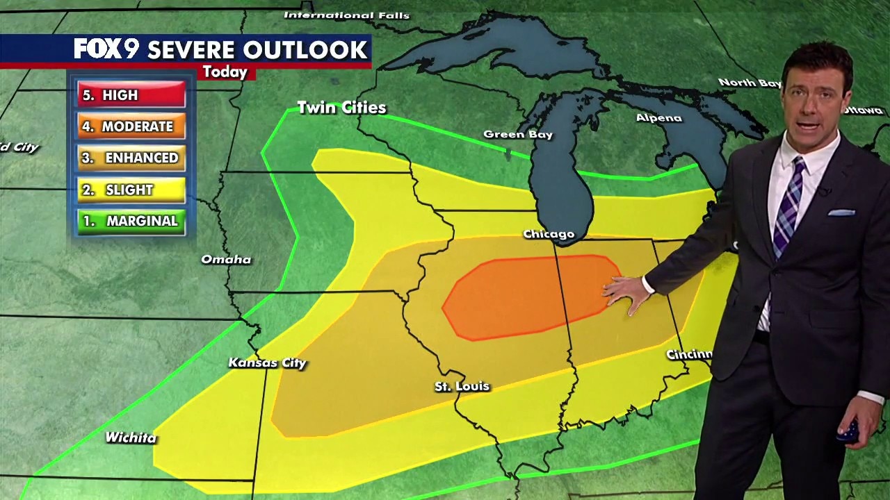
The Twin Cities metro is under a Level 1 severe threat, while southern and southeastern Minnesota is under a Level 2. The greatest threat with these storms is hail between .50" and 1.25" in diameter. There is also a chance for locally heavy downpours, and wind gust in excess of 60 mph.
1:15 p.m. - Ground stop issued at MSP Airport
The Minneapolis-St. Paul International Airport issued a ground stop just after 1:15 p.m. Wednesday due to heavy rain and thunderstorms in the Twin Cities area. The ground stop is in effect for planes coming to the Twin Cities from Chicago, Denver and Kansas City.
It's not clear when the ground stop will be lifted.
Extended Minnesota weather forecast
What's next:
Thursday looks dry and comfortable, with mostly sunny skies and temperatures remaining slightly below average in the 70s.
Another system arrives Friday, bringing scattered showers and a few isolated thunderstorms, though not everyone will get wet.
The weekend looks pleasant overall, with highs holding in the 70s on Saturday. A few showers and storms are possible during the first half of Sunday before conditions improve later in the day.
Temperatures remain comfortable into early next week, with highs in the mid to upper 70s.
Here's a look at the seven-day forecast:

(FOX 9)
The Source: This forecast uses information from FOX 9 meteorologists.