

Minnesota weather: Late day strong storms possible Wednesday
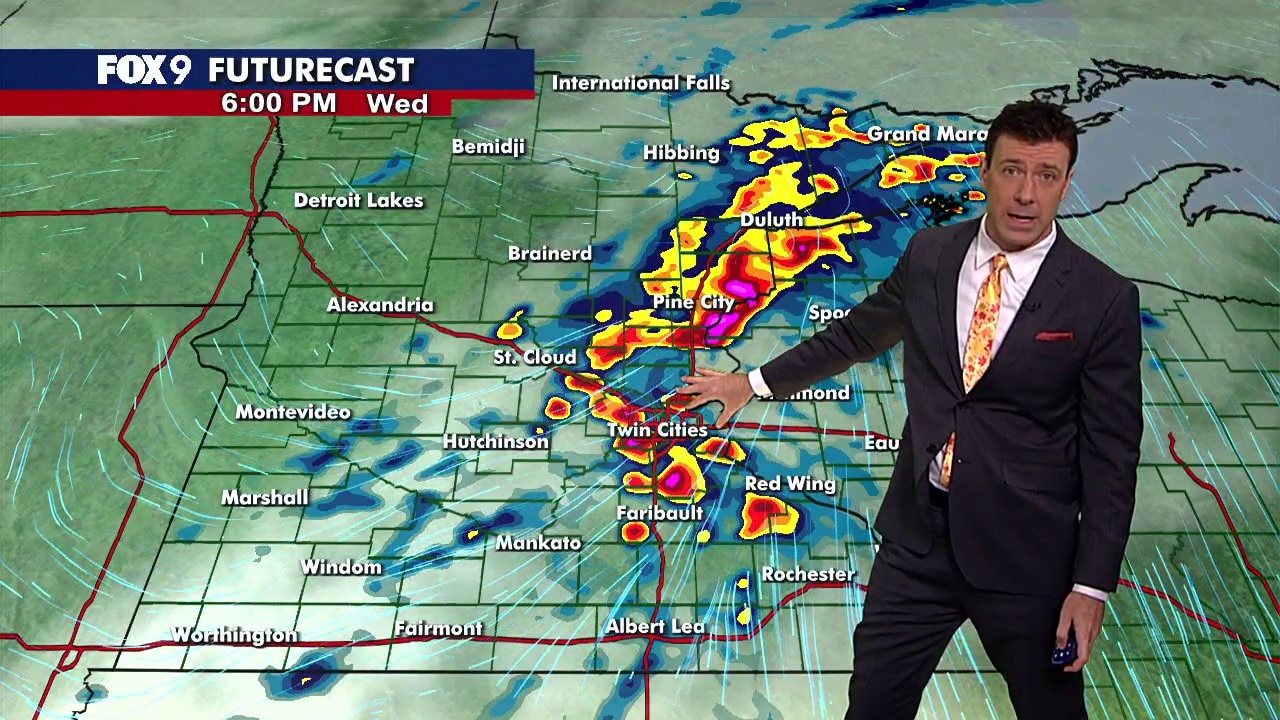
MN weather: Late day strong storms possible Wednesday
Wednesday stays mild and humid with some patchy sunshine before scattered thunderstorms develop during the afternoon and evening. There's a Level 2 slight risk for severe weather, including isolated tornadoes, large hail and damaging winds. FOX 9 meteorologist Cody Matz has the forecast.
MINNEAPOLIS (FOX 9) - Minnesota will see a mild and humid Wednesday with some patchy sunshine before scattered thunderstorms develop during the afternoon and evening.
Wednesday's forecast in Minnesota
The forecast:
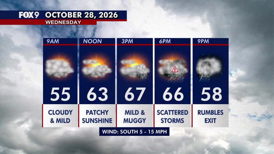
Wednesday stays mild and humid across much of Minnesota, with some patchy sunshine possible as clouds try to break up throughout the day.
Temperatures climb into the 60s across central and southern Minnesota, with some 70s in southeastern areas. Northern Minnesota stays cooler in the 50s. The Twin Cities metro daytime high is around 67 degrees, accompanied by southerly winds at 5–15 mph.
(FOX 9)
An area of low pressure moving across the state will help spark scattered thunderstorms during the afternoon and evening. The storms will quickly move to the east, leaving behind a quiet Wednesday night with overnight lows in the 40s.
Strong storms possible Wednesday
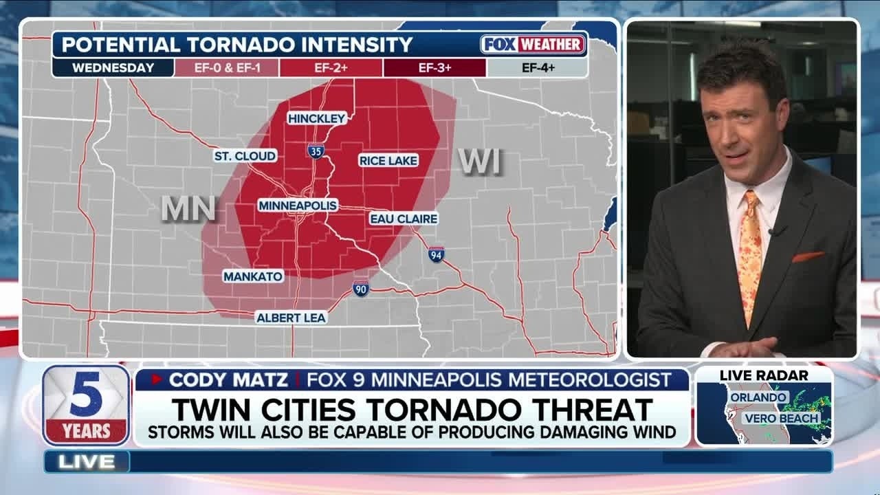
Tornado threat for Twin Cities on Wednesday
FOX 9 meteorologist Cody Matz joins FOX Weather to discuss the tornado threat for the Twin Cities metro area Wednesday. Storms are expected to develop in Minnesota during the afternoon and evening, with tornadoes, damaging winds and hail possible.
What to expect:
Scattered thunderstorms are expected to develop across western Minnesota during the early to mid-afternoon before moving east across the state.
The Twin Cities metro and surrounding areas face a Level 2 slight risk for severe weather, while a broader portion of Minnesota and western Wisconsin is under a Level 1 marginal risk.
However, this is a conditional severe weather threat, meaning the ingredients for strong storms are in place, but they may not all come together. Thunder and lightning are expected, though the potential for severe weather will depend on how conditions develop throughout the afternoon, including how warm temperatures get.
Some storms could produce isolated tornadoes, hail of 1 inch or larger and wind gusts exceeding 60 mph. If temperatures get warm enough, a strong tornado is possible.
The main window for severe weather is 2 p.m. to 9 p.m., with the greatest chance for stronger storms in the Twin Cities between 4 p.m. and 8 p.m.
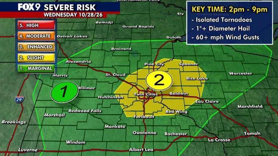
Severe risk map as of Wednesday morning.
Extended Minnesota weather forecast
What's next:
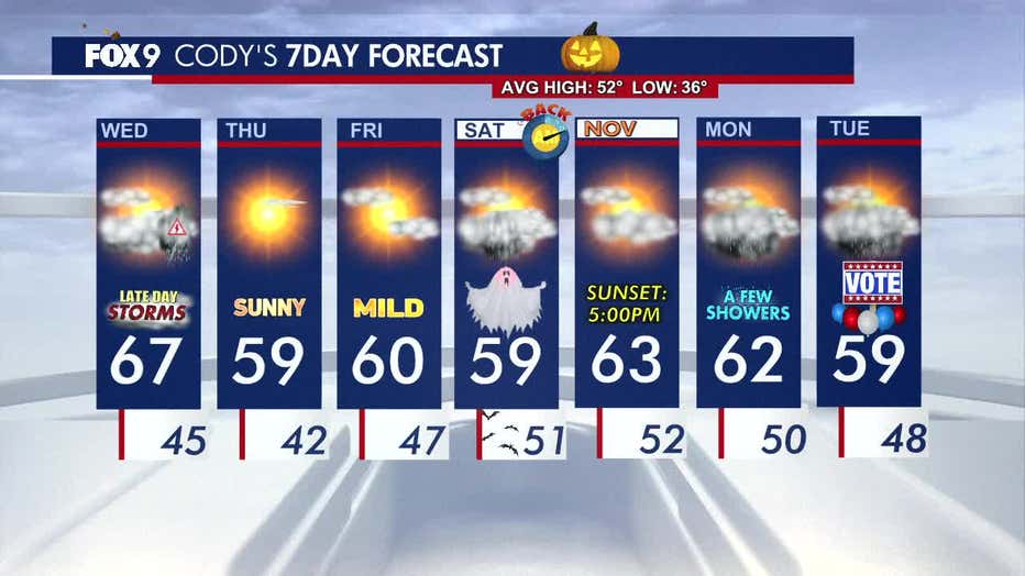
Thursday turns much brighter as sunshine and blue skies return, accompanied by a light breeze. Temperatures cool slightly, with the Twin Cities metro topping out just shy of 60 degrees.
A few light showers or drizzle are possible on Halloween before temperatures warm into the 60s Sunday.
Similar temperatures continue into early next week, with additional shower chances possible Monday and Tuesday.
Here's a look at the seven-day forecast:
(FOX 9)
The Source: This forecast uses information from FOX 9 meteorologists.