Minnesota weather: Warm and breezy, showers Wednesday night
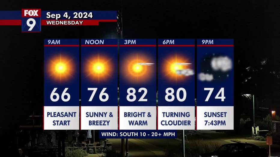
MINNEAPOLIS (FOX 9) - It's a bright, warm, and breezy day ahead of shower chances returning Wednesday night.
Wednesday's forecast
Much of Minnesota has temperatures in the 80s, but northern parts of the state are slightly cooler with highs in the 70s. The Twin Cities metro daytime high is 82 degrees.
A cold front is slowly edging eastward on Wednesday, dragging wildfire smoke along with it. Northwest Minnesota is under an air quality alert starting at 5 p.m. on Wednesday, where the thickest smoke is expected. But, most of the state will likely see some wildfire smoke within the next day or two.
Wednesday will be fairly sunny and breezy, with winds out of the south at 10-20+ mph. Cloud coverage starts increasing around the dinner hour as chances for scattered showers return. Northwestern Minnesota has the highest chance for rain, but a shower can't be ruled out in the metro overnight into Thursday morning.
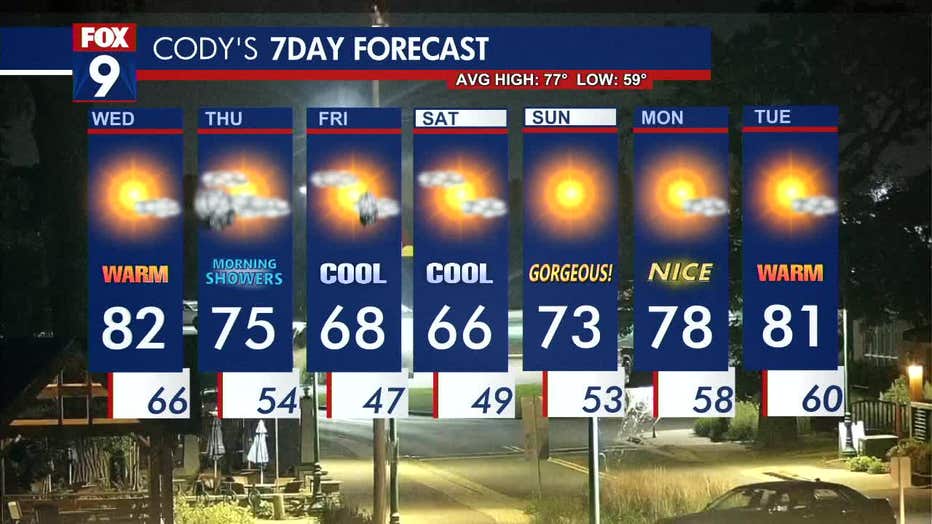
Fall-like temperatures return
The clouds will thin out on Thursday, allowing some late-day sunshine, but they will return on Friday afternoon, with chances for more scattered rain.
Temperatures start to cool on Thursday, with a high of 75 degrees. As we head into Friday and the weekend, it feels more like fall as temperatures dip into the 60s.
Things heat back up as we head into the week as temperatures are back in the 80s by Tuesday.
Here's a look at your seven-day forecast: