MN weather: Record warm December-January, but will our warmth last the rest of winter?

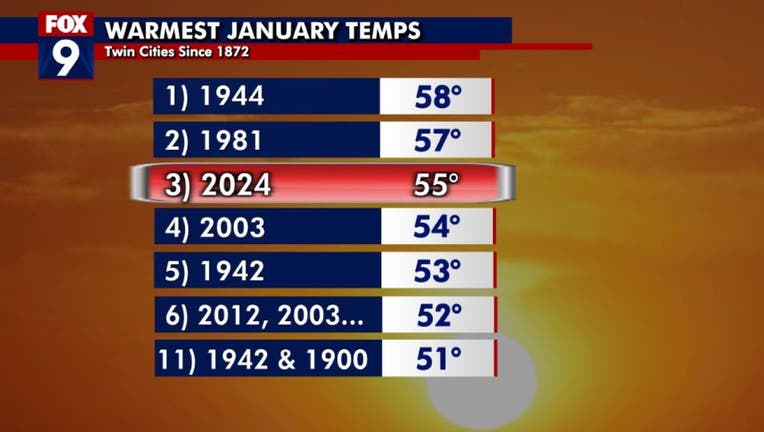
MINNEAPOLIS (FOX 9) - It's clearly been a very warm winter so far. Well, now we know it's been the warmest on record to this point, with an exclamation point right at the end as the Twin Cities experiences its third-warmest January day on record.
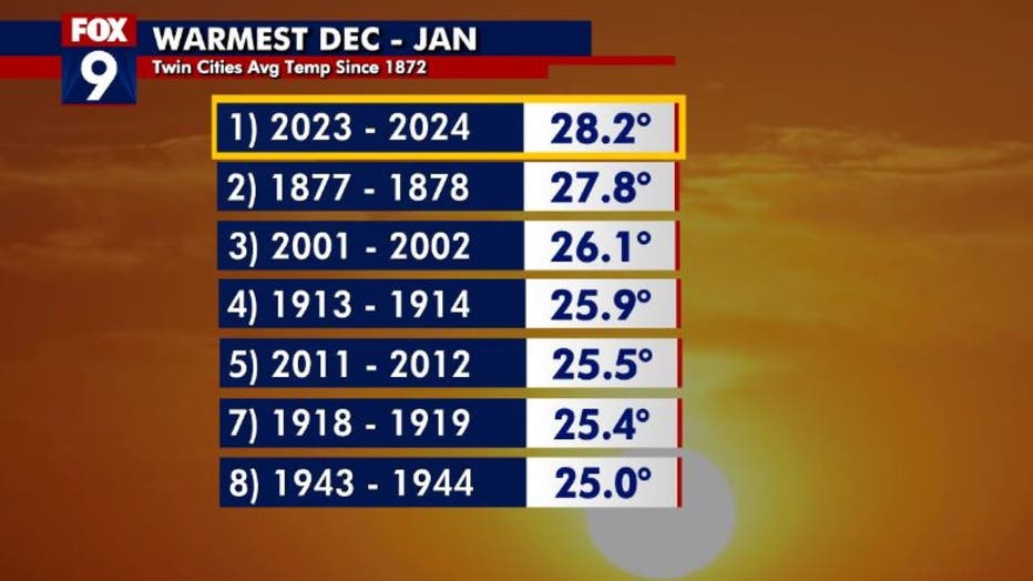
The combo of December and January is now topping the list for the warmest those have been back-to-back over the last 150 years or so, dating back to 1872. For those that have lived in Minnesota a while, this may sound somewhat familiar. The first two thirds of the winters of 2011-2012 and 2001-2002 were very warm as well, making the top five list.

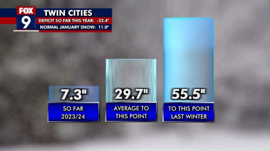
Both of those winters were below average in snow too, but this year pretty much takes the cake so far. To date, the Twin Cities has received just a little over 7 inches of snow for the season, with our snowiest calendar day still Halloween. For comparison’s sake, we should have seen roughly 30 inches of snow on average and had already received over 55 inches by this same time last year.
I realize this sounds nefarious, but year-to-year variability is completely normal. Now obviously, this time around, the difference from year to year is about as large as it can get when it comes to the overall amount of snow — and to some extent, our temperatures.

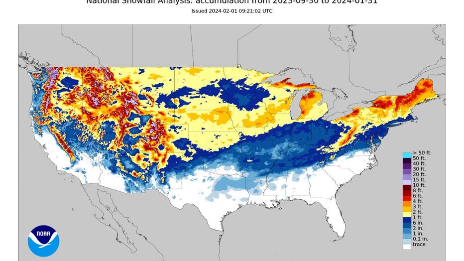
Because of our snow drought, many other areas of the U.S. have seen more snow. The season-to-date snowfall map of the Lower 48 shows a very clear "snow hole" in central and southern Minnesota where less than 10 inches of accumulation have occurred so far. Just off to our south in Iowa, Nebraska, and southern Wisconsin, some spots have received nearly seven times more snow so far this winter than the Twin Cities. Even small parts of Tennessee, Arkansas, and Mississippi have received more snow.

The big question now is, are we done with winter? Well, here are some friendly reminders:
- We are never "overdue" for a snowstorm. Just because we haven't seen a lot of snow yet doesn't mean that we are "due" to get walloped in March or April. Sometimes it just doesn't snow. Our chances for snow are roughly the same every year. However, they do trend low in El Niño years, which we are currently experiencing.
- There is no correlation between a very warm winter and a hot summer.
- The snow season in the Twin Cities often runs into April, and can go into May — so we have a long way to go.
- Our lack of snow can impact lake and river levels in the spring because there likely won't be any runoff. However, the amount of spring moisture, both rain and snow, has a much larger impact on potential drought and water levels than anything that falls over the winter.
- The overall trend for winter temperatures has been warming for years, but the opposite has been occurring for our spring months of March and April. Both have seen an overall cooling trend since 2010. While there are certainly exceptions, this could mean that colder weather is still more likely as we head closer to spring.
- The next several days will likely stay quite warm. However, there are signs that a pattern change will lead to much cooler temperatures going into mid-February, so I seriously doubt winter is done with us just yet. But we'll just have to wait and see.

MN weather: Cooler and bright Thursday
The start of February will be bright and cooler, with a high of 47 degrees in the Twin Cities metro area. By the weekend, it will continue to feel more like spring with warmer temperatures.

