Evening storms track across Minnesota after near record-high 80s

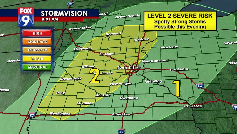
Severe weather risk for Monday, April 5 (FOX 9)
MINNEAPOLIS (FOX 9) - An early April heat wave peaked Monday with near record-high temperatures in the low 80s, but the heat gave way to some severe weather Monday evening.
A wind from the south this afternoon pushed a warm air mass across the Upper Midwest. The warm air coupled sunshine and higher dew points created hot and somewhat more humid conditions in the afternoon that set the stage for possible storms this evening.
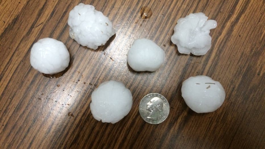
Golf ball-sized hail was reported in Maple Lake, Minn. after 8 p.m. Monday night.

Ryan Elke sent in a photo of hail larger than a quarter in Maple Lake, Minnesota.
As with all active weather scenarios we search for a spark or a trigger to set things in motion. That trigger will evolve early Monday evening as a cold front rolls in from the west. Storms look likely to develop along the cold front as it moves from west to east across the FOX 9 viewing area this evening.
Overall timing for storm chances will be from 6 p.m. until midnight and the primary threats are damaging winds and large hail.
Chief Meteorologist Ian Leonard will be in the weather center all evening to help you Stay Sky Aware on FOX 9 and fox9.com/live.
Track storms live on the FOX 9 Weather App with interactive radar and futurecast. Download it for Android or Apple.

