

Unusually warm temperatures globally as summer officially begins
EDEN PRAIRIE, Minn. (FOX 9) - It has felt a lot like summer for a few weeks now, but it officially kicks off at 9:57 Wednesday morning. The warmth here in Minnesota though pales in comparison to other parts of the world as earth is experiencing a spike in temperatures over the last few months.
While we are in the midst of a stretch of 90s, other parts of the world are much hotter. After big heat waves earlier this spring that have taken thousands of lives from Southeast Asia to India to parts of Africa, the Southern United States and Mexico are now one of the hottest parts of the planet when compared to average.
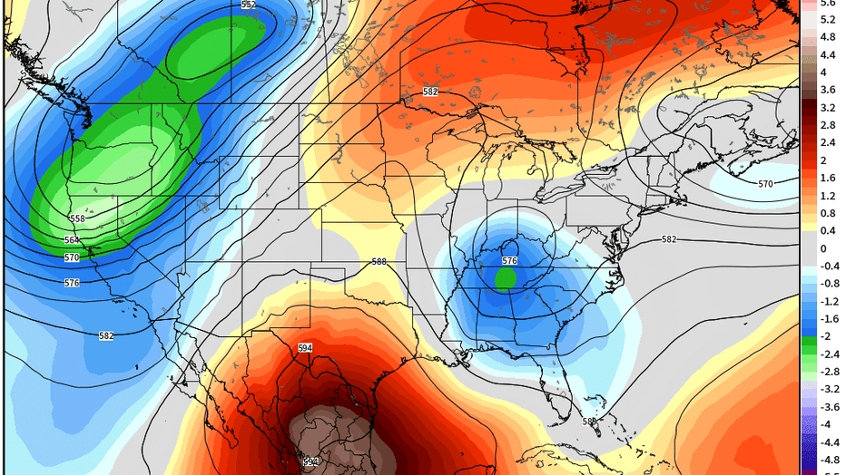
A heat dome over parts of the Southern United States.
A heat dome, seen as a big red blob on this map, shows much of Mexico, Texas and Louisiana experiencing temperatures more than 4 standard deviations above normal. In layman's terms, this is heat rarely seen even for this part of the world with all-time record highs falling and the heat index topping 125° in some areas for multiple days. I know many around here will say, "yeah, it's Mexico. It's Texas. It's supposed to be hot." You're right, but even for them, this is a really long hot stretch.
Now this heat dome may wax and wane a little moving forward, but this loop shows the possible forecast for this dome over the next couple of weeks, showing it could hang around a while, and even expand northward into more parts of the United States as we get into July.
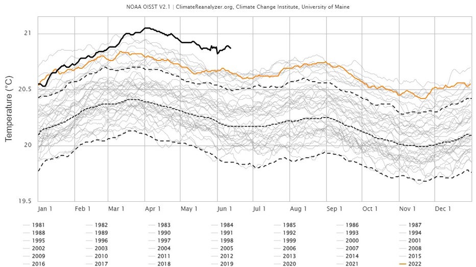
Temperatures globally.
This is on top of truly unprecedented warmth across many parts of the globe...And I don't use that term lightly. Here is a chart showing the average temperature of the surface of the oceans around the world. That dark black line on top that is far above every year since records began back around 1980...That's this year.
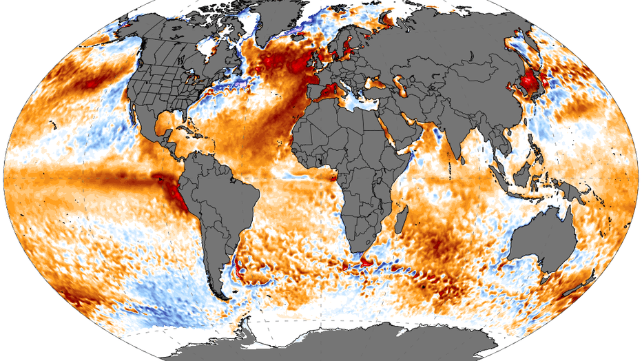
Ocean temperatures globally
Another way to look at it is with this map showing sea surface temperatures around the world when compared to the late 20th century average. All of the orange and red areas are above average... And those encompass a lot of area. Some of the warmest spots are in the North Atlantic with temps nearly 10 degrees above average. These incredibly warm waters could lead to a building heat wave across Europe next week that has the potential to produce triple digit heat all the way to the Arctic Circle. Not to mention... Add more fuel for the Atlantic hurricane season that's just getting started.
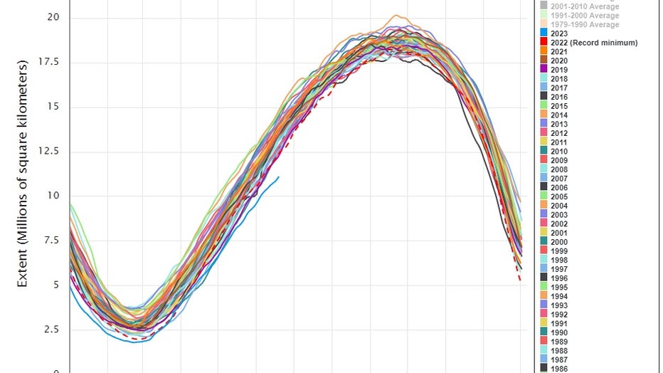
Sea ice levels in the Arctic since the 1970s.
The warm waters appear to be taking their toll on sea ice as well...This chart shows the annual wax and wane of Antarctic sea ice since the 1970s. That blue line in the middle of the graph below all the other lines clustered together. That's this year... Showing by far the lowest sea ice extent at this time of year since 1979.
So now the question is why is this sudden warming happening? Is this just a blip or is this going to be permanent? And the answer is we really don't know. While El Niño is likely at least partially a factor, many climate scientists are baffled by just how quickly things have warmed lately.

June snow in Alberta, Canada (jasperlocal.com)
And to show that there are certainly some areas that are cooler than average...Here is what it looked like near Jasper in Alberta, Canada on Monday where nearly a foot of snow fell stranding hundreds on area roadways and mountain campgrounds.