Minnesota weather: Tropical warmth, strong storm chances return Thursday
MN weather: Strong storm chances Thursday afternoon
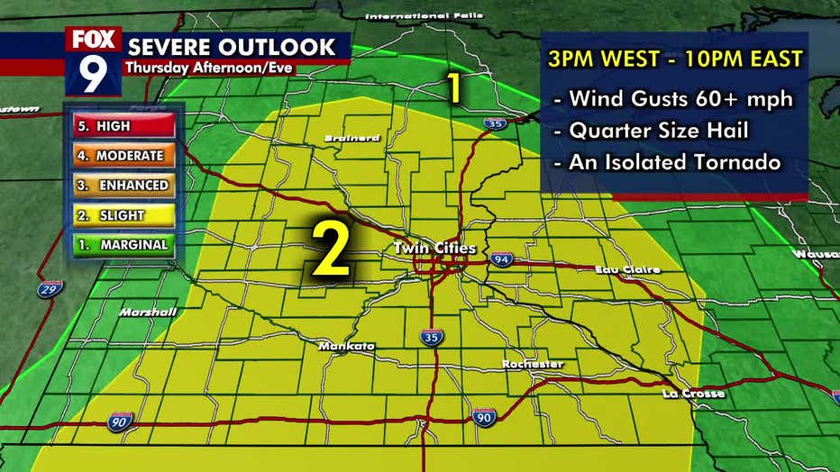
Quickly building tropical warmth will set the stage for likely another active afternoon. These quick-moving storms could bring straight-line winds, torrential rain, lightning, and an isolated tornado. The Twin Cities metro is under a Level 2 Slight Risk for severe weather. FOX 9 meteorologist Cody Matz has more on the storm.
MINNEAPOLIS (FOX 9) - Thursday will be warm and toasty, with dew points in the 70s and more chances for strong storms later in the afternoon.
Thursday’s forecast
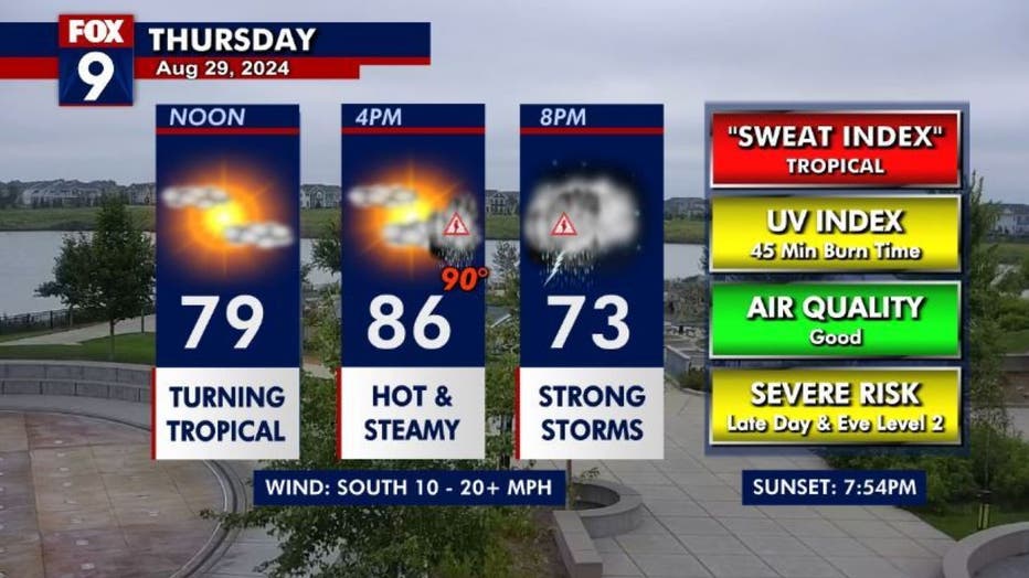
It’s a hot and sticky day with temperatures in the mid to upper 80s and dew points in the 70s, giving it a tropical feel. Thursday is breezy with southerly winds at 10-20+ mph.
The day starts quietly in the Twin Cities metro area ahead of some mid to late-afternoon storms. Once the system pushes out, the overnight hours are clear and calm with temperatures in the mid-60s.
Storms on Thursday
On Thursday morning, south-central Minnesota wakes up to isolated storms, while a few stronger storms are moving through northwestern Minnesota.
On Thursday, the Twin Cities metro and much of central and southern Minnesota are under a Level 2 Slight Risk for severe weather. The western edge of the state and parts of northern Minnesota are under a marginal risk.
The storms will arrive in central and western Minnesota around 3 p.m. and roll east, reaching the Twin Cities metro sometime between 4 and 8 p.m. on Thursday. The storm is quick-moving and will push out of the area around 10 p.m. These storms have the chance for 60+ mph winds, torrential downpours, quarter-size hail, and an isolated tornado.
Labor Day weekend
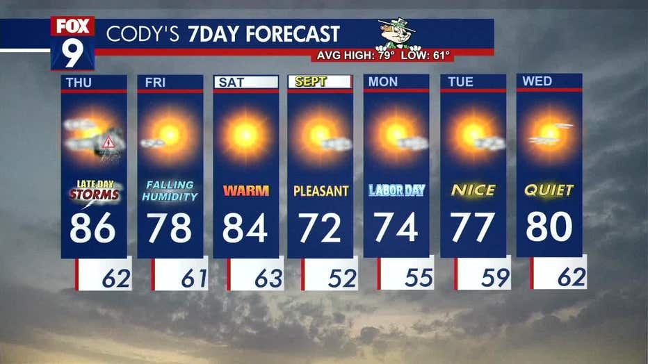
Thursday’s storms set the stage for a beautiful Friday and holiday weekend. Temperatures and dew points will lower on Friday, with highs in the mid-70s. The clouds will also push out for plenty of sunshine.
Things warm slightly for Saturday with temperatures back into the mid-80s for a more typical summer day with plenty of sunshine.
As we head into Sunday and Labor Day, temperatures are starting to feel more like fall with highs in the mid to lower 70s. But temperatures are warming back into the upper 70s and lower 80s by mid-week.
Here’s a look at your seven-day forecast: