

Minnesota weather: Warm, sticky Thursday; strong storms possible later
MINNEAPOLIS (FOX 9) - It’s another warm and sticky afternoon as thunderstorms bookend the day on Thursday.
Thursday forecast
MN weather: Warm, sticky Thursday; bookend storms
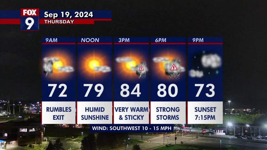
It's another summer-style day with dew points in the upper 60s and a high of 84 degrees in the Twin Cities metro. Thunderstorms bookend the day on Thursday, with the possibility for stronger storms later in the day. FOX 9 meteorologist Keith Marler has your forecast.
Isolated storms will sweep through on Thursday morning before pushing off to the east. While these storms could produce heavy downpours, lightning, and thunder, they are not expected to be severe.
After the initial round of activity, the afternoon will be mostly quiet, but humidity will increase as dew points climb into the upper 60s and lower 70s, making for muggy conditions. Temperatures remain above average in the mid-80s, with highs reaching 84 degrees in the Twin Cities metro.
Later in the day, as a cold front approaches, storms are expected to redevelop between 3 p.m. and 8 p.m. in the metro area. These storms bring a level 2 slight risk of severe weather for eastern Minnesota, including the Twin Cities. The system could bring golf ball size hail, wind gusts of 60+ mph, and isolated tornadoes.
By the evening, the storms will clear, leaving mostly clear skies and overnight lows in the 60s.
(FOX 9)
Looking ahead
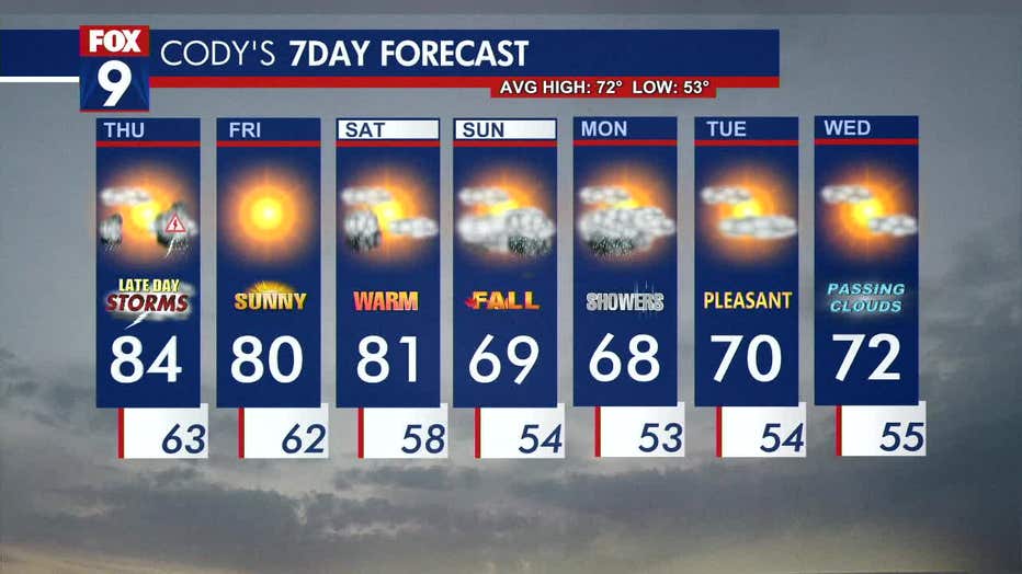
Friday is expected to be a far drier and more comfortable day as dew points drop into the 50s and temperatures hover around 80 degrees. Enjoy the abundance of sunshine and the warmer weather before cooler temperatures arrive for the weekend.
Saturday is another warm day with a high of 81 degrees and the possibility for a couple of morning drips. Temperatures return closer to seasonable for the first day of fall on Sunday and remain in the upper 60s and lower 70s as we head into the week.
Here’s a look at your seven-day forecast:
(FOX 9)