Minnesota weather: The last of our 'hot' days on Monday
MINNEAPOLIS (FOX 9) - Monday is likely the last "hot" day of the season before cooler temperatures arrive for the first day of October.
Monday’s forecast
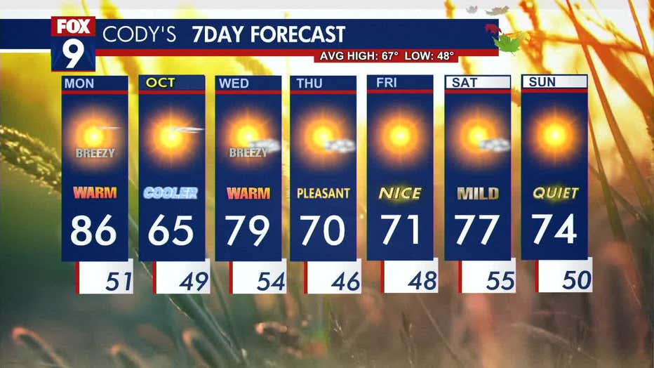
Monday will bring another warm, summer-like day across much of Minnesota. Central and southern regions can expect temperatures in the mid-80s, while northern and western areas will see cooler highs in the 70s.
The day will start with plenty of sunshine, though a few clouds will move in by the late afternoon. Winds will pick up, shifting from the south to the northwest at 10-20+ mph. These warm, dry, and breezy conditions have prompted a red flag warning for wildfire risks in parts of central and western Minnesota. The dry spell is expected to continue for at least the next week.
A cold front will move through later in the day, with winds increasing and temperatures dropping overnight into the 40s across the state, with pockets of 50s in the metro area.
Cooler start to October
Fall-style weather welcomes the first day of October on Tuesday before warmer temperatures return on Wednesday.
Tuesday, the first day of October, will bring more fall-like conditions. Dew points will drop significantly from the mid-50s into the 20s, making temperatures feel cooler. Expect highs in the 60s, with the Twin Cities reaching around 65 degrees, close to the seasonal average.
By Wednesday, southerly winds will return and bring warmer air back into the region with temperatures nearing 80 degrees. Thursday and Friday will see highs in the lower 70s, followed by fluctuating temperatures during the weekend.
Here's a look at your seven-day forecast:


