

MN weather: A weak polar vortex could lead to an early fall freeze
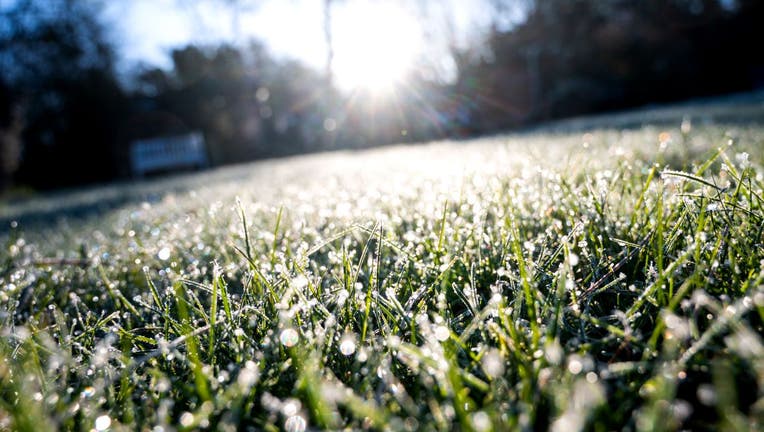
Ice crystals and water drops hang on blades of grass in a meadow in the morning. In the background the sun is shining. Photo: Daniel Bockwoldt/dpa (Photo by Daniel Bockwoldt/picture alliance via Getty Images)
MINNEAPOLIS (FOX 9) - Much cooler air is set to arrive in the Upper Midwest for Friday and Saturday, which will bring a nice taste of fall to much of the area.
Freezing temperatures are highly unlikely, but some 30s will be possible for some folks, which could lead to the first frost for some isolated spots across our north and some rural areas. This first push of fall-style air is the result of a few atmospheric conditions that line up... One of which is a weak polar vortex. This could lead to other big cool downs later this month.
READ MORE: Big cool down could lead to frost in parts of MN by the weekend
What is the polar vortex?
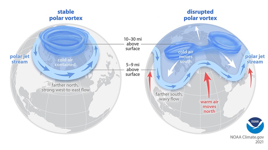
Polar vortex explainer.
The polar vortex is a large circulation of lower pressure and cooler air that's constantly rotating counterclockwise high up in the stratosphere above the North and South poles.
Despite the pop culture term referring to the polar vortex "moving and bringing much colder air with it," it never actually moves, nor does it ever entirely disappear. But much like everything else in our atmosphere, it will wax and wane from stronger periods to weaker periods.
During these weaker periods, which can last days, weeks or months, the much cooler air lurking underneath it can "spill" out of the poles and head for the midlatitudes, including the Lower 48 states. Well, the polar vortex is currently in one of these weaker periods and is currently forecast to stay that way for at least the next few weeks.
Will we see a cool fall?
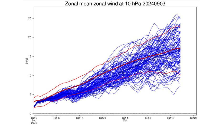
Zonal wind.
The image above is a chart that shows the current and forecast strength for the Northern Hemisphere polar vortex. It is referred to as the zonal wind at the 10 hPa (hectopascals) level in the atmosphere, which is roughly 50,000 feet above our heads.
There are dozens of lines on the chart, so let me breakdown what you're viewing. The bold middle red line is the average polar vortex strength over time. The top and bottom red lines are the extremes of the vortex, both strong and weak. Then all the blue lines are different computer model projections of what will happen in the next few weeks, with the thicker dark blue line showing the average of all of those forecasts.
The takeaway here is that the bold blue line is forecast to stay below the bold red line. This indicates the current average forecast is that the polar vortex is likely to be weaker than average right into at least early October.
This could lead to cold air spilling out of the poles more than normal and bring an earlier-than-average freeze for some spots of the Northern Hemisphere. Does that mean it will happen here in Minnesota? No, not necessarily, but there is a higher-than-average probability.
Could this lead to a cold and snowy winter?
The polar vortex itself doesn't necessarily dictate whether we have a very cold and snowy winter overall. I mean, we have had some big arctic outbreaks during each of the last few winters and yet half of our winters have been well above average.
But what may be interesting to note is how the state of the atmosphere right now here in early September compares to other years at this time and what then occurred the following cold season. We call these analogs or taking what has occurred before now to see the potential of what may happen moving forward.
With the world transitioning from a third consecutive year of El Niño, to now a La Niña, along with the combination of a seasonable summer around here but a very hot summer in the Desert Southwest, could give us an idea of what's to come. The last time both of these occurred was the summer to early fall of 1993.
Well, here is what average temperatures were like between the end of 1993 and the start of 1994 across the U.S.
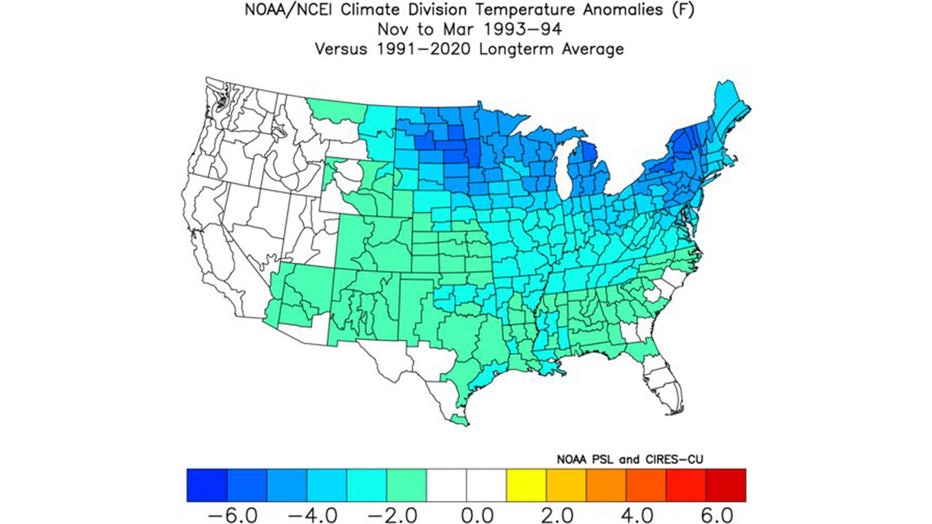
Climate anomalies between the end of 1993 and start of 1994.
The green and blue on this image indicate below-average temperatures with the darker blues showing well below-average temperatures.
It's clear that this time period was very cold compared to average for a lot of the U.S. with the coldest air sitting from Minnesota to the Northeast.
This does not indicate exactly what we will see this winter but does indicate that we may have a higher probability of enduring some colder-than-average temperatures by the start of winter. Of course, this would be almost the exact opposite of what occurred last winter, which wound up well above average.