

Minnesota weather: A very warm and dry September
MINNEAPOLIS (FOX 9) - Hey Mother Nature, can we just have a "normal" month, please? It's one of the most overused weather descriptors, but it certainly tracks here.
This year (2024) has been all about the "weather whiplash". Yes, that hurt a little to type, but it certainly applies to this year, especially when referring to our precipitation. It started with the sheer lack of snow over the winter, but we still received a couple of larger storms to round out the season. Those wet conditions continued and drastically ramped up over the spring with exceedingly wet conditions from late spring through much of the summer. But then the rain shut off.
Dry September
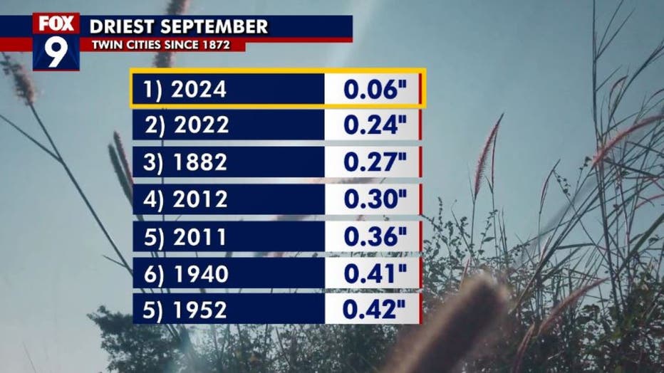
It's been a dry September in Minnesota. (FOX 9)
It was active through the State Fair, but then the rain just dried up as we entered September. And now, the official climate site of the Twin Cities, MSP Airport, has only received 6 hundredths of an inch of moisture this month. This would be the smallest amount of rain recorded here in the Twin Cities for the month since records began in 1872.
READ MORE: Minnesota weather: Another stunning fall day Monday
With the current forecast showing almost no chance of rain before the end of the month, this record will likely hold.
Temperatures gradually rising
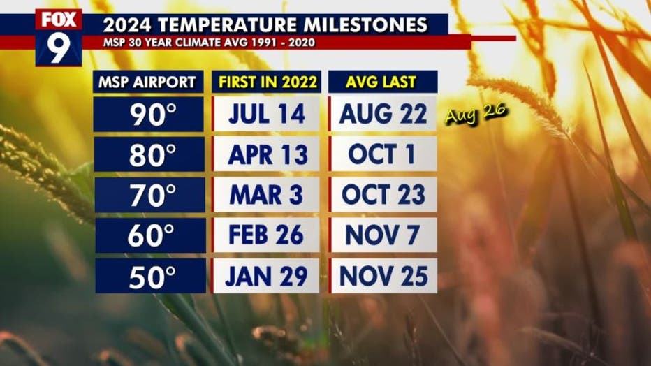
Temperatures are also expected to gradually rise through the end of the week as well as we make another run for 80 degrees. And while that number is above average, it's not all that unusual. The Twin Cities average last 80-degree day is right around the first of October in an average year, so another 80-degree day before the week is done would be perfectly normal.
Now with daylight continuing to get shorter and some of our cooler mornings, the fall colors should really ramp up over the next week or so. In fact, parts of the Arrowhead may begin to peak in color before the week is done. We'll have an update on fall colors over the next couple of days.

MN weather: A stunning fall day on Monday
A beautiful fall-style day kicks off the workweek with plenty of sunshine and a high of 70 degrees in the metro. Temperatures remain more reasonable for the start of the week before heading back into the upper 70s and lower 80s for the remainder of the week. FOX 9's meteorologist Cody Matz has your forecast.