

MN weather: How Tropical Storm Debby is giving Minnesota a 'cool' few days

MN weather: Light showers possible later Wednesday
Wednesday is overall pleasant, with temperatures in the mid-70s, but scattered light rain could return later in the day. FOX 9's meteorologist Cody Matz has your forecast.
MINNEAPOLIS (FOX 9) - After plenty of warmth and high humidity for the last couple of weeks or so, we're now getting a break, largely thanks to what is now former Hurricane Debby.
Since the atmosphere is connected, everything has a direct or indirect relationship with each other. Think of it like the butterfly effect but on a much grander scale and a proven science variable as opposed to just theoretical. So, a tropical system has a direct impact on the atmosphere around it, which then affects systems both upstream and downstream. Because of this, often when tropical systems make landfall in the southeastern U.S., Minnesota will have a very pleasant and cooler stretch of weather.
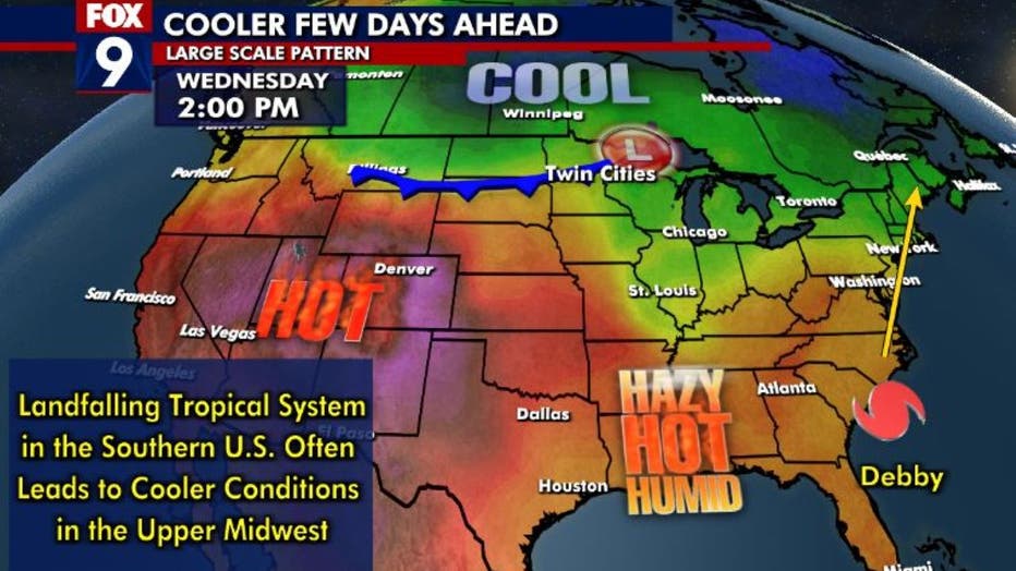
Wednesday forecast. (FOX 9)
This is because as tropical systems move into the eastern Gulf of Mexico, they pull plenty of moisture and warm tropical air northward with it. Since the atmosphere can't have any empty space because it's a fluid, the air then has to replace the air that's moving northward with the tropical system. Often, the times that air comes from farther north. That sets off a chain reaction that leads to northerly breezes across much of the center of North America. Well, air coming in from Canada and the Arctic isn't super cold like it would be in the winter, but it's certainly much cooler than air coming out of the tropics. These northern breezes will bring cooler air and can bring some substantial cold fronts to the Upper Midwest similar to what we're seeing through the end of this week.
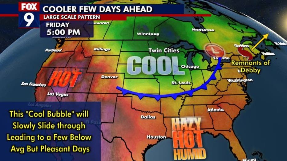
Friday forecast.
Now there are exceptions to this "rule". The location where the tropical system makes landfall has a large part to do with what our weather pattern will be. The eastern half of the gulf is ideal from New Orleans to the west coast of Florida. Farther west, like Houston or northern Mexico, could be too far west, actually increasing the warmth around here and potentially bringing heavy rain to the area if the upper-level remnants move into the state. Farther east, like the Carolinas, it can center this post-tropical cool down toward the East Coast as opposed to the Midwest. So, in those cases, we often see cooler temperatures, but they can be quite brief.
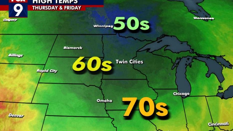
High temperatures.
This time around, though, it's practically perfect with a west coast Florida landfall and a very slow-moving system that allows Canada to leave the window open to Minnesota for several straight days.
This is bringing below-average temperatures to the Upper Midwest for the better part of a week, peaking Thursday and Friday with highs mostly in the 60s. Enjoy!