

Minnesota weather: Another bright, hot and humid day Tuesday
MINNEAPOLIS (FOX 9) - The heat continues for another bright and humid day on Tuesday.
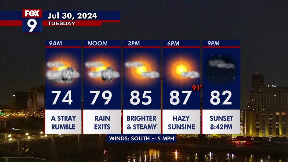
Tuesday’s forecast
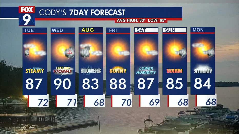
This week is more of the same, with hot and humid conditions and a chance for cluster storms in the late day and overnight hours.
A stray rumble or shower is possible on Tuesday morning, but it will clear out for a bright and steamy day. The afternoon will feature plenty of sunshine, which will be hazy thanks to wildfire smoke in the atmosphere.
Much of Minnesota has highs in the mid to upper 80s. The Twin Cities metro daytime high is 87 degrees with dew points in the upper 60s, making things feel sticky.
More storms are possible overnight into Wednesday, with a higher chance in southern Minnesota. Overnight will be mild for most, with temperatures in the upper 60s and lower 70s.
(FOX 9)
Midweek forecast
Wednesday gets even steamier with dew points in the 70s, making for a muggy day. Highs are nearing 90 with feels like temperatures close to 100 in some areas.
Scattered thunderstorm chances return overnight into Thursday morning with some showers lingering into the first half of the day. Wednesday has the highest chance for widespread rain compared to the cluster and pop-up thunderstorms on other days.
Temperatures dip slightly on Thursday to a high of 83 degrees, and we could get a break from the storms on Friday and Saturday. The humidity will also lower later this week, making for slightly more comfortable conditions.
Here’s a look at your seven-day forecast:
(FOX 9)