Light snow continues Friday, but bulk of accumulation done

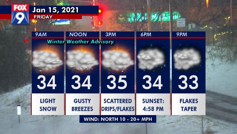
Hourly forecast for Friday, January 15, 2021.
(FOX 9) - The snow will gradually wind down through the day Friday, with the bulk of the accumulation from this winter storm done.
There may be some very minor additional accumulations into the evening hours in parts of southern Minnesota. Gusty breezes will slowly relax late Friday morning and into the evening as well, but drivers still need to be very cautious with reduced visibility in southwestern Minnesota due to blowing snow.

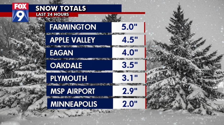
Snow totals in the Twin Cities metro as of Friday morning. (FOX 9)
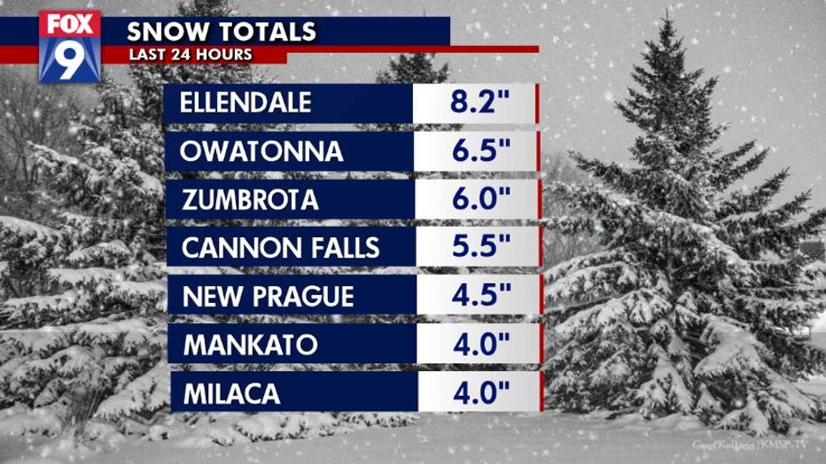
Snow totals across the Twin Cities metro generally range from 2-5 inches with the metro core on the low end because it holds onto our relative warmth a lot more efficiently, which prevented some of the falling snow from accumulating. Much of southern Minnesota is in the 4-8 inches category, with the most falling around the Albert Lea area.

Snow totals in Greater Minnesota as of Friday morning. (FOX 9)
Roads will stay mostly wet and slushy Friday afternoon as temperatures stay in the low to mid-30s and scattered flakes hang around through the dinner hour.
Temperatures finally dip back below freezing overnight Friday into early Saturday which will likely create some icy patches on the roads as we refreeze, so plan accordingly if you’re traveling during the first part of your weekend.
Stay up to date on the winter weather by downloading the FOX 9 Weather App. It has the latest temperatures, snow totals, forecasts and school closings 24/7. Download it for Android or Apple.

