Minnesota weather: Another surge of humidity keeps summer alive on Tuesday
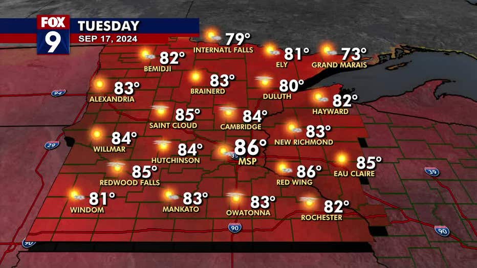
MINNEAPOLIS (FOX 9) - Summer continues to hang on for another very warm and humid day on Tuesday.
Tuesday forecast
Rumbles in western Minnesota on Tuesday morning will likely fall apart before reaching the Twin Cities metro area. However, that system will bring partly cloudy skies in the morning before the sunshine returns in the afternoon.
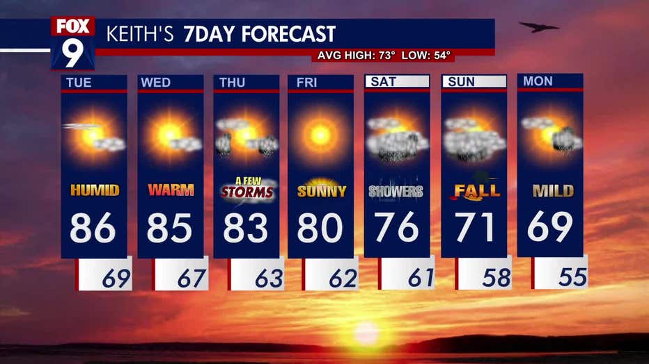
It’s another muggy, summer-style day with temperatures in the mid-80s and dew points in the mid-60s. The Twin Cities daytime high is 86 degrees, well above the average high of 73 degrees.
The humidity and warmth lingers overnight as temperatures remain in the upper 60s with the occasional passing cloud.
(FOX 9)
Rain on the way
Wednesday is still a touch muggy with some patchy cloud coverage, but it will be an overall bright afternoon with temperatures in the mid-80s.
The dry stretch is coming to an end as evening storms arrive in western Minnesota on Wednesday and push east. The storms will linger into Thursday morning, with the possibility of redevelopment in the afternoon and evening, creating some on-and-off rumbles.
Friday is dryer before a larger system brings in cooler temperatures and more chances for widespread rain heading into the weekend.
Here’s a look at your seven-day forecast: